Ratzer Map of NYC in 1770
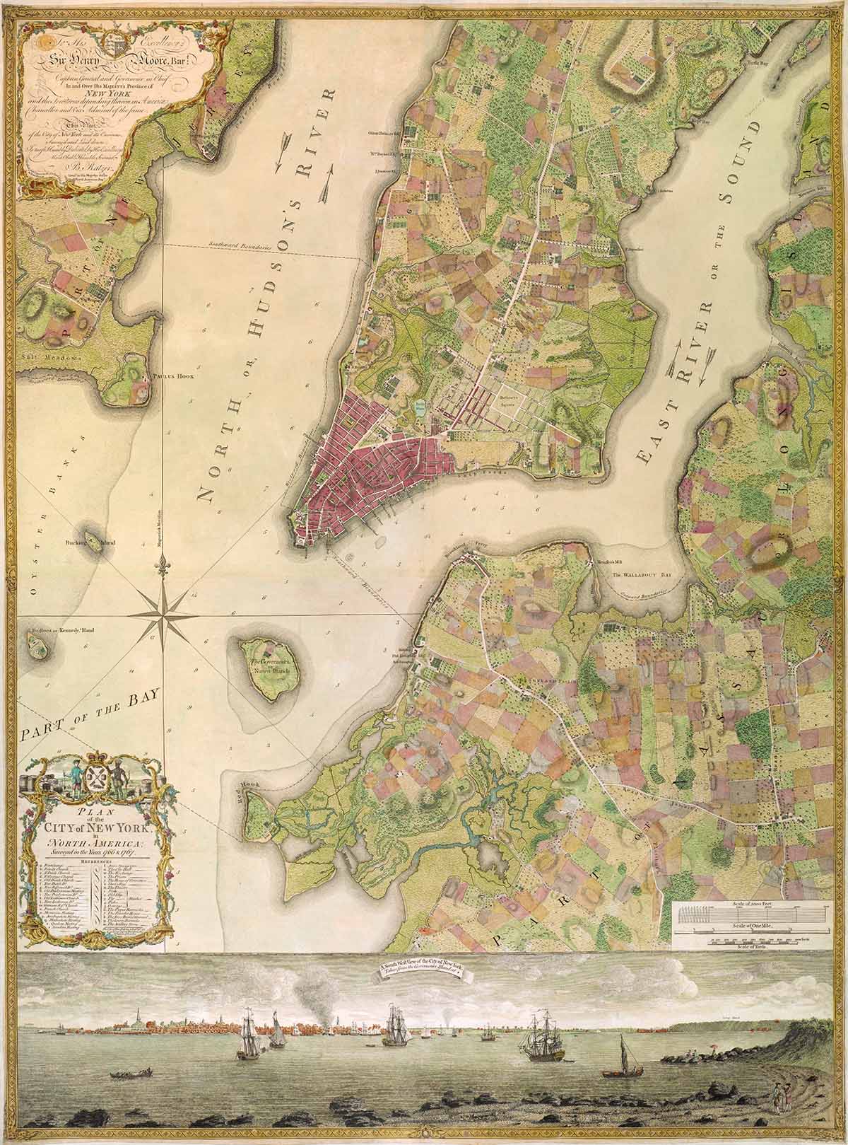

Ratzer Map of NYC in 1770
The Plan of the City of New York in North America by British military officer Bernard Ratzer, created in 1766-1767 and printed in 1770.
The Ratzer Map offers a detailed view of Brooklyn and Manhattan in the years leading up to the Revolutionary War. The Brooklyn Historical Society detailed the map and its importance:
"It shows two views of a bustling and growing city set amid fields and forests. A large map provides a birds-eye view of lower Manhattan Island, eastern New Jersey, and—across the East River—the farms of “Brookland” (Brooklyn). At the bottom of the map, Bernard Ratzer included a view of busy New York harbor as seen from Governor’s Island. This panorama shows an incredible level of detail, including ships, buildings, and the coastline. It is so detailed that it even shows smoke rising from buildings in Manhattan. The Ratzer Map gives us many clues about New Yorkers of 240 years ago. We see the development of city infrastructure, including sometimes twisting, sometimes grid-like roads. Clusters of buildings indicate where most people lived and worked. The names of farms and large estates tell us who owned land. The map shows important natural features, such as swamps, ponds, rivers and streams. It also shows us ways that New Yorkers changed the natural landscape by planting pastures, orchards, and gardens."