Cart
0
Home
Longform
Brutal NYC
BLOG
Store
Back
East Side Access
WTC UPDATE
Twenty Exchange
Times Square Theater
Barclay Vesey Building
One Clinton
Favorites
Back
Store Home
Photography
Maps and Drawings
Cart
0
Home
Longform
East Side Access
WTC UPDATE
Twenty Exchange
Times Square Theater
Barclay Vesey Building
One Clinton
Favorites
Brutal NYC
BLOG
Store
Store Home
Photography
Maps and Drawings
No results found
Category
All
Brooklyn
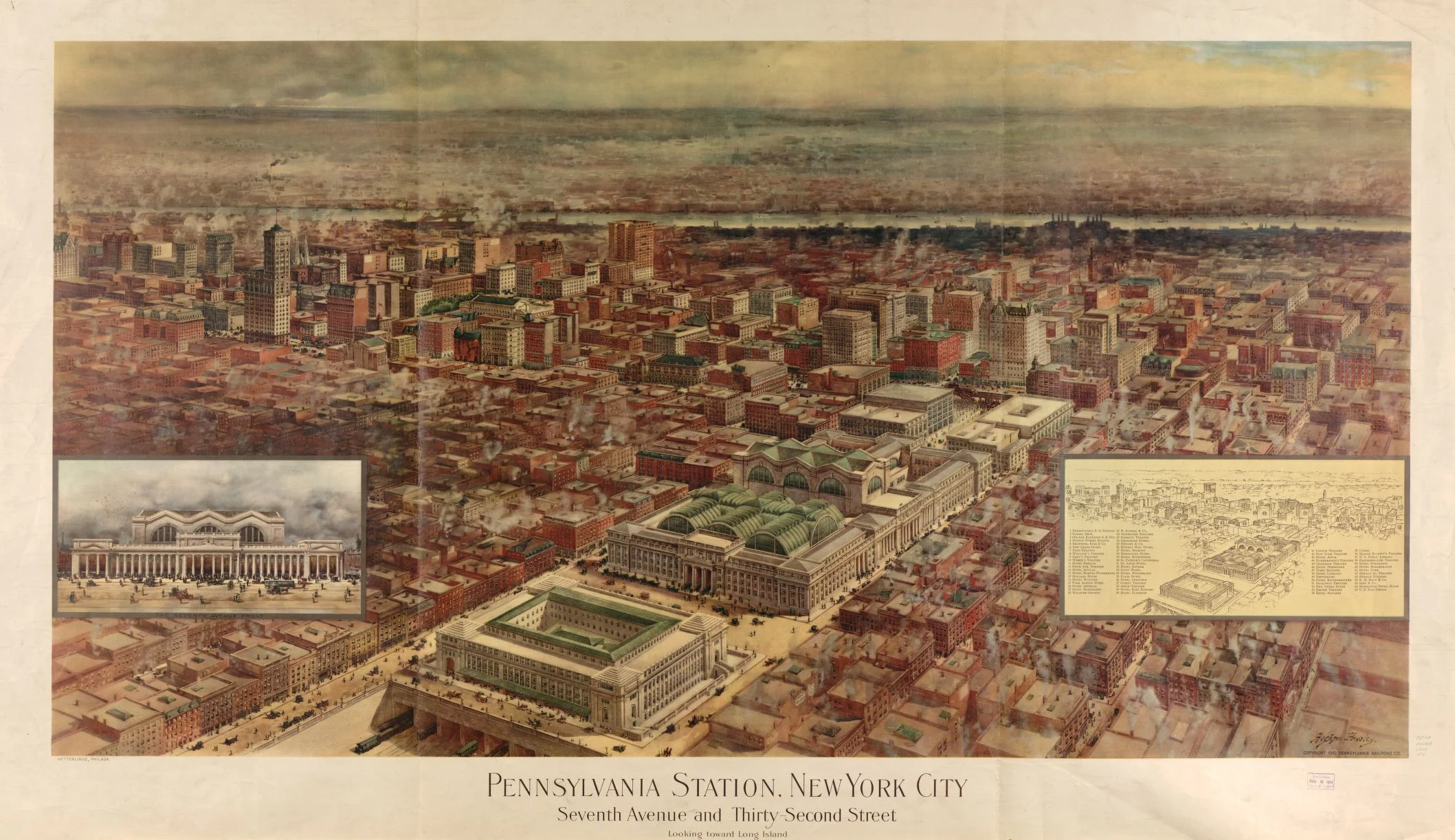
Penn Station
Transit
sale
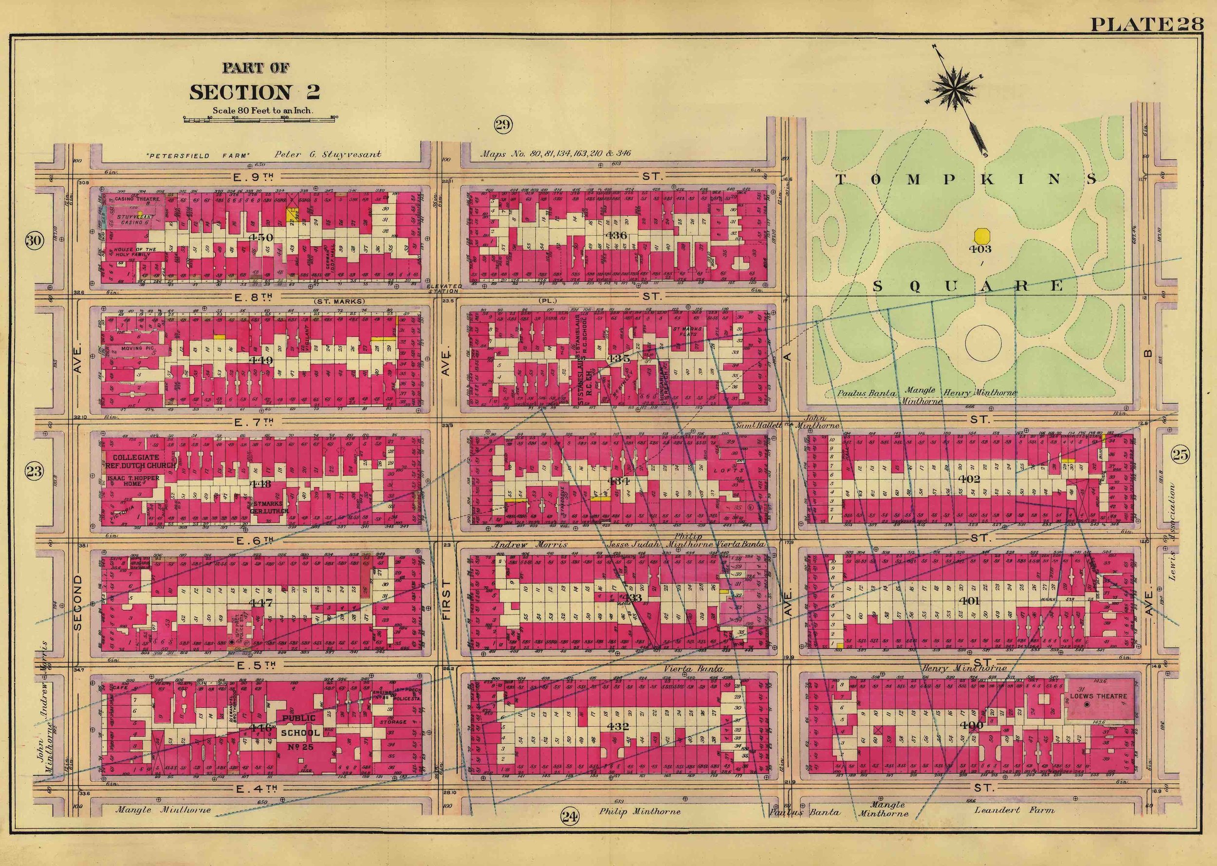
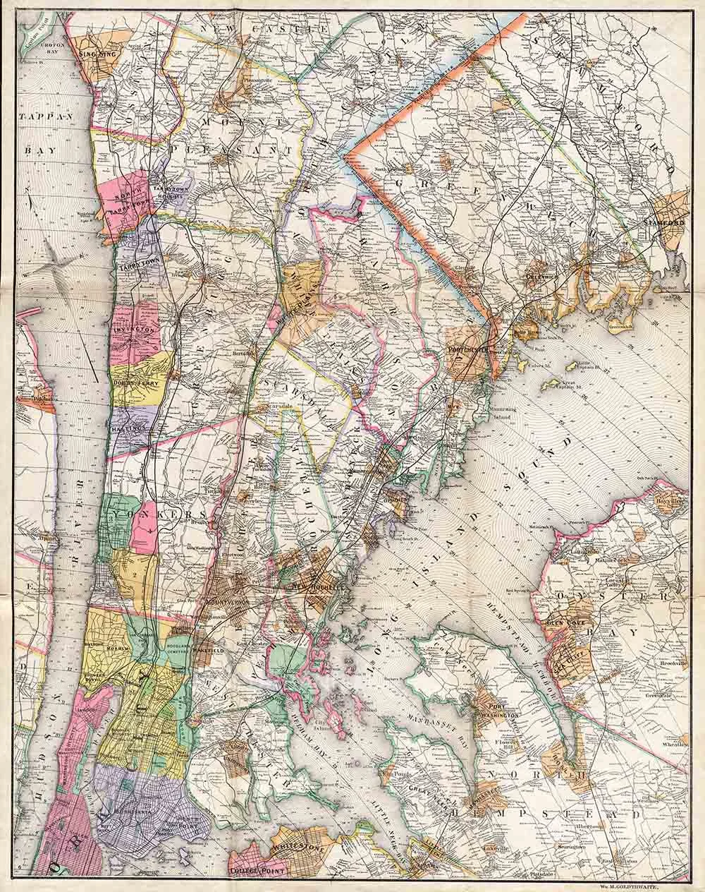
Custom Historic NYC Land Maps
Sale Price:
$44.97
Original Price:
$49.99
sale
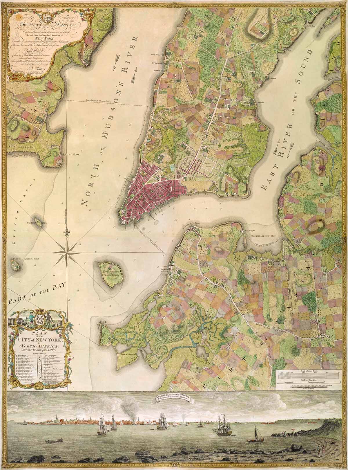
Ratzer Map of NYC in 1770
Sale Price:
$39.99
Original Price:
$70.99
1972 Vignelli Subway Map
from $24.99
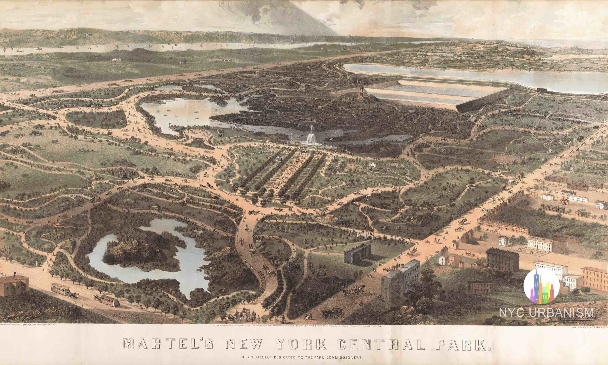
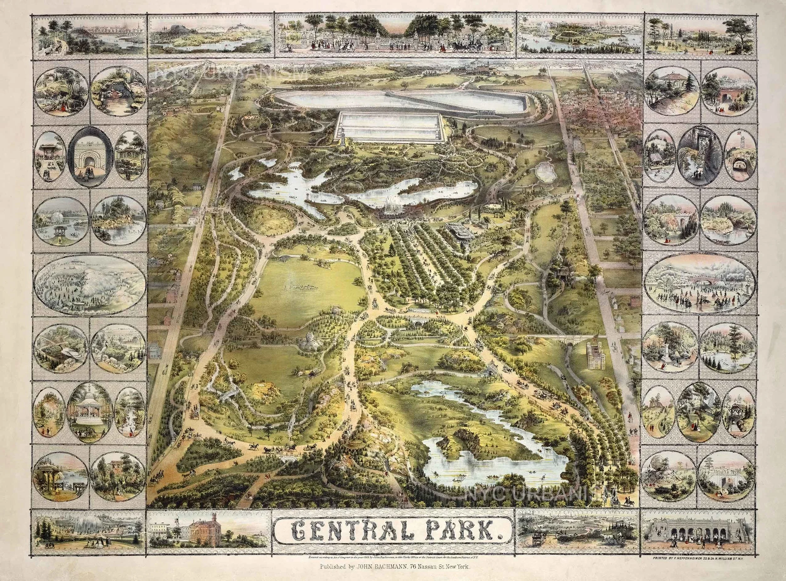
Bird's Eye View of Central Park, 1873
from $19.99
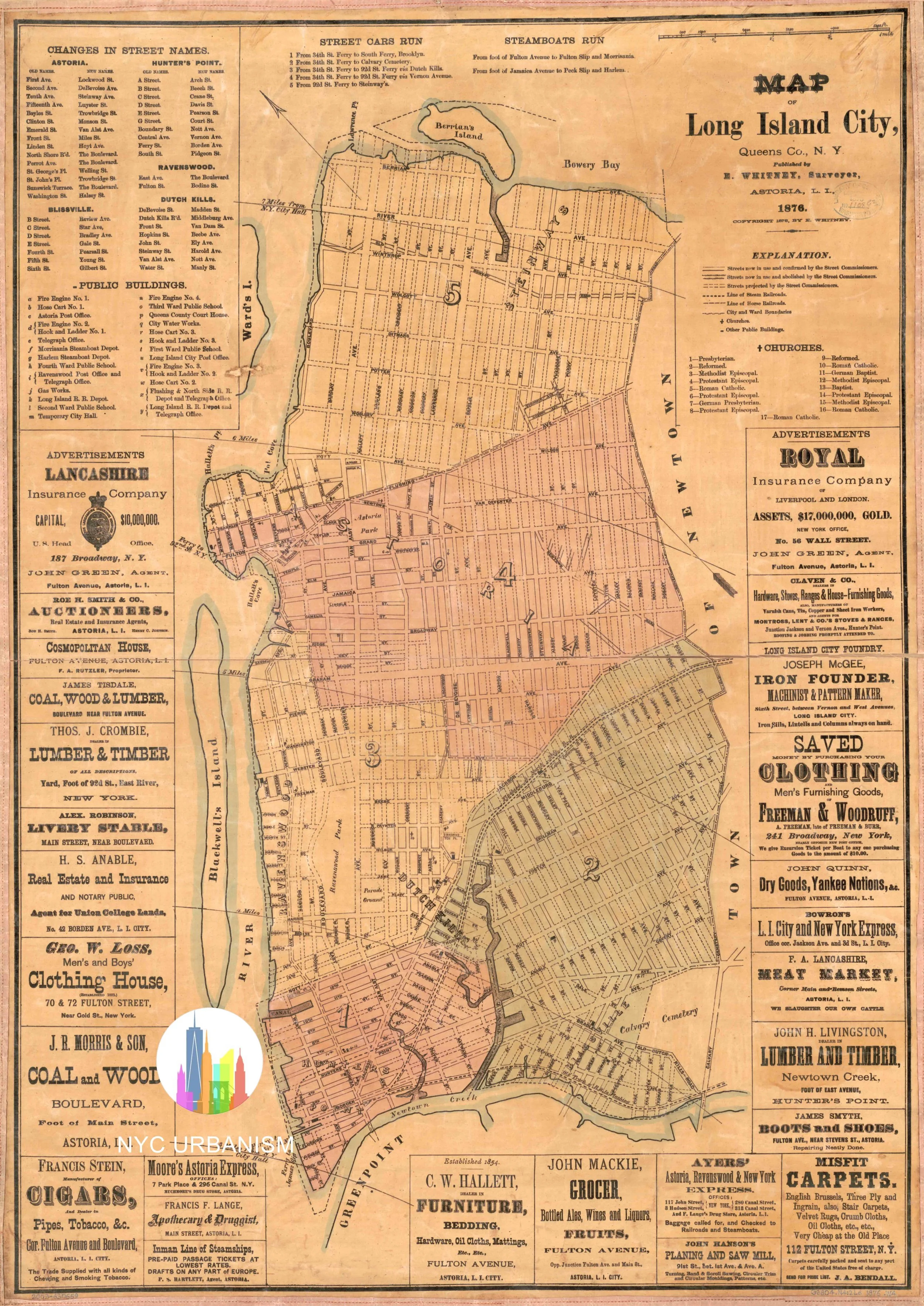
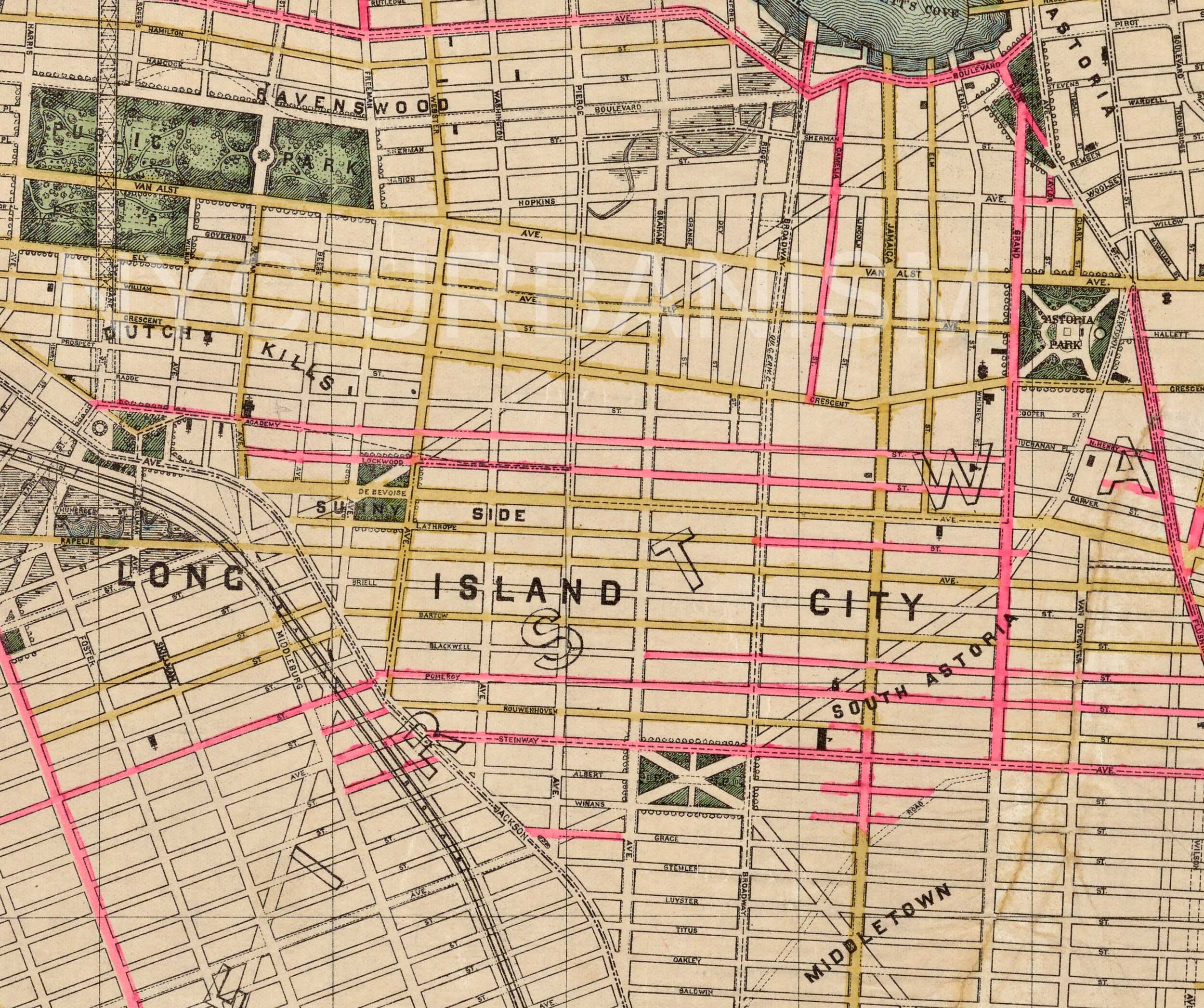
1876 Map of Long Island City
from $19.99
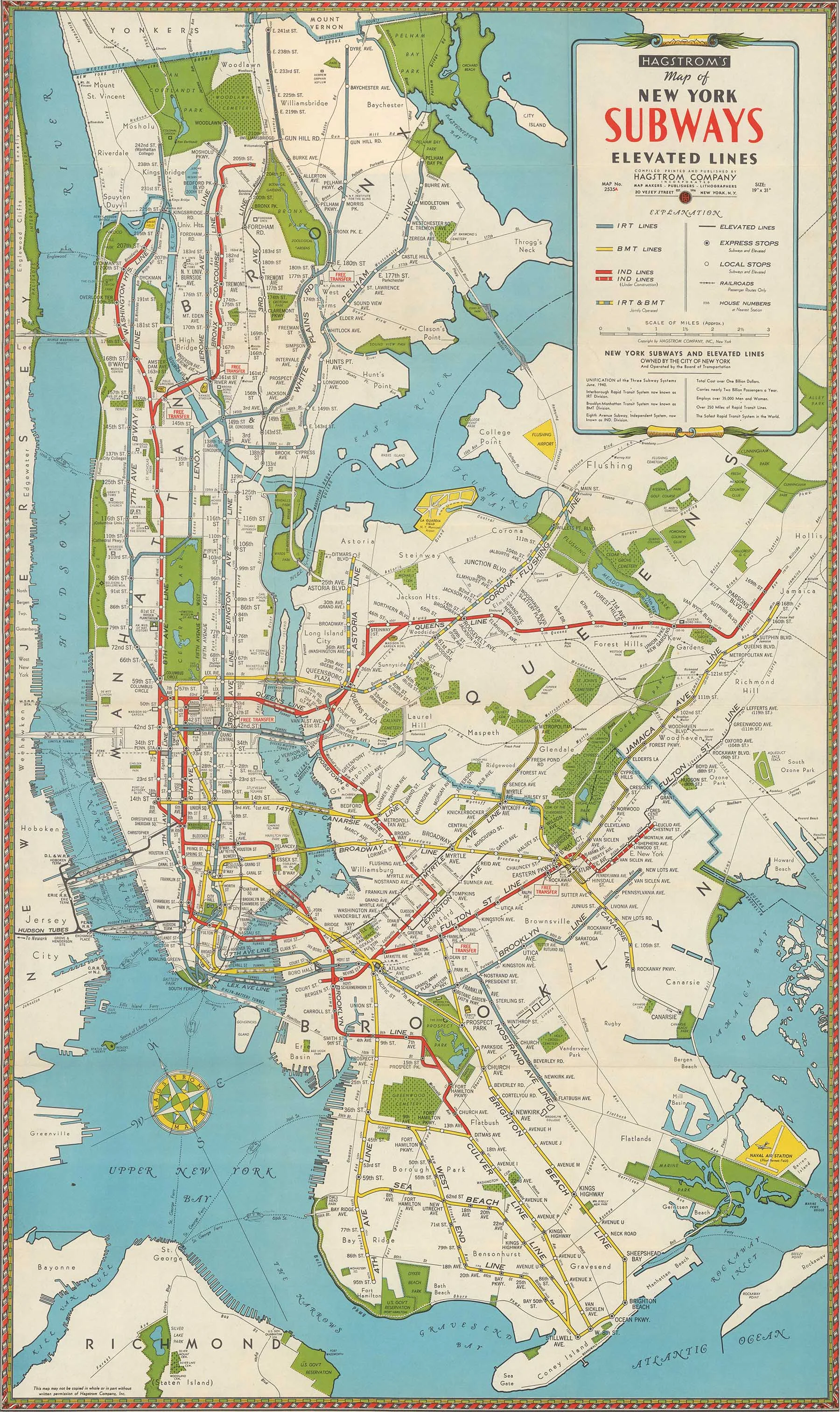
1942 Subway Map
from $24.99
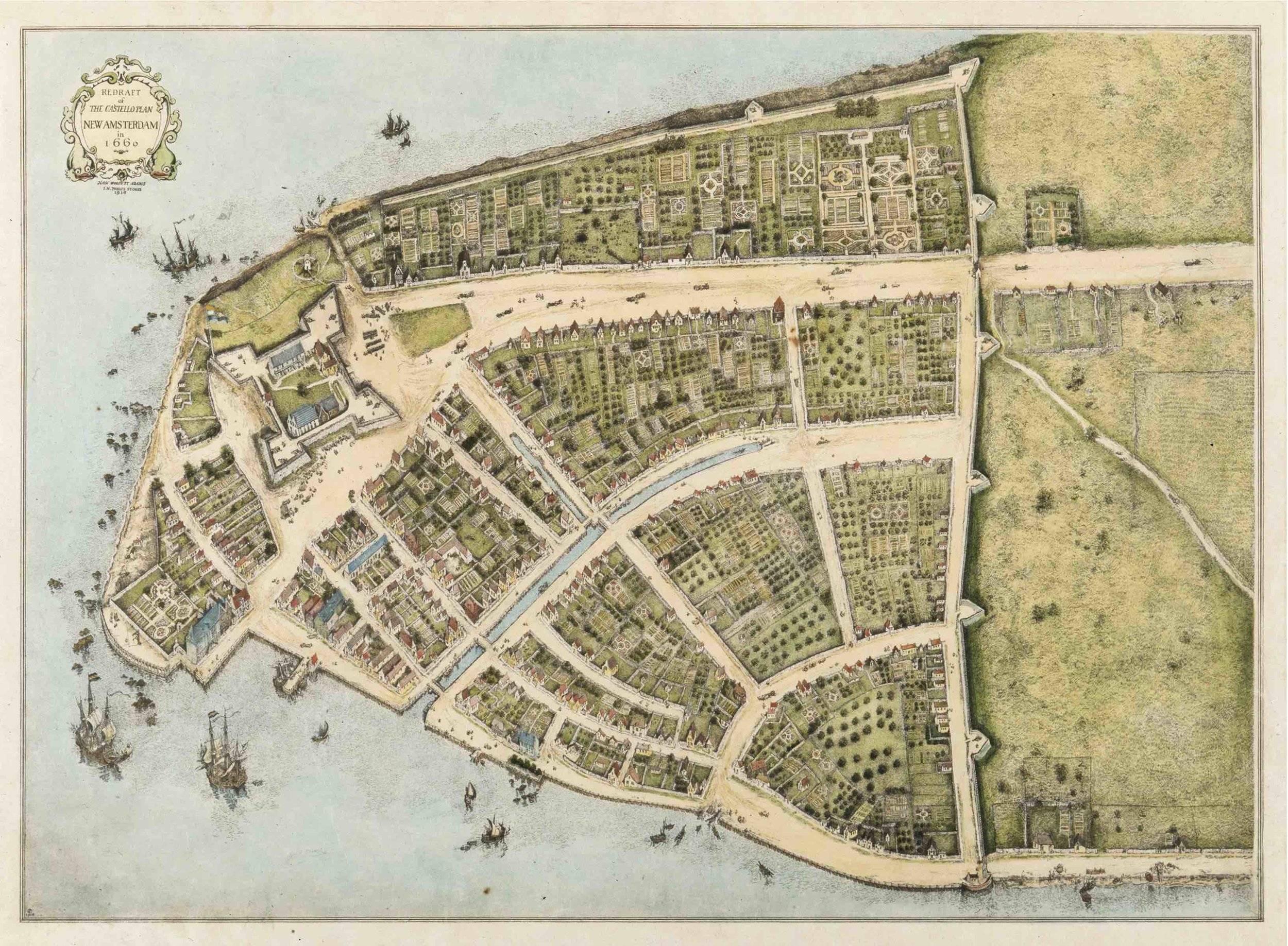
Castello Plan, NYC 1660
from $19.99
1954 Subway Map
from $15.99
Taylor Map, 1879
$22.99
sale
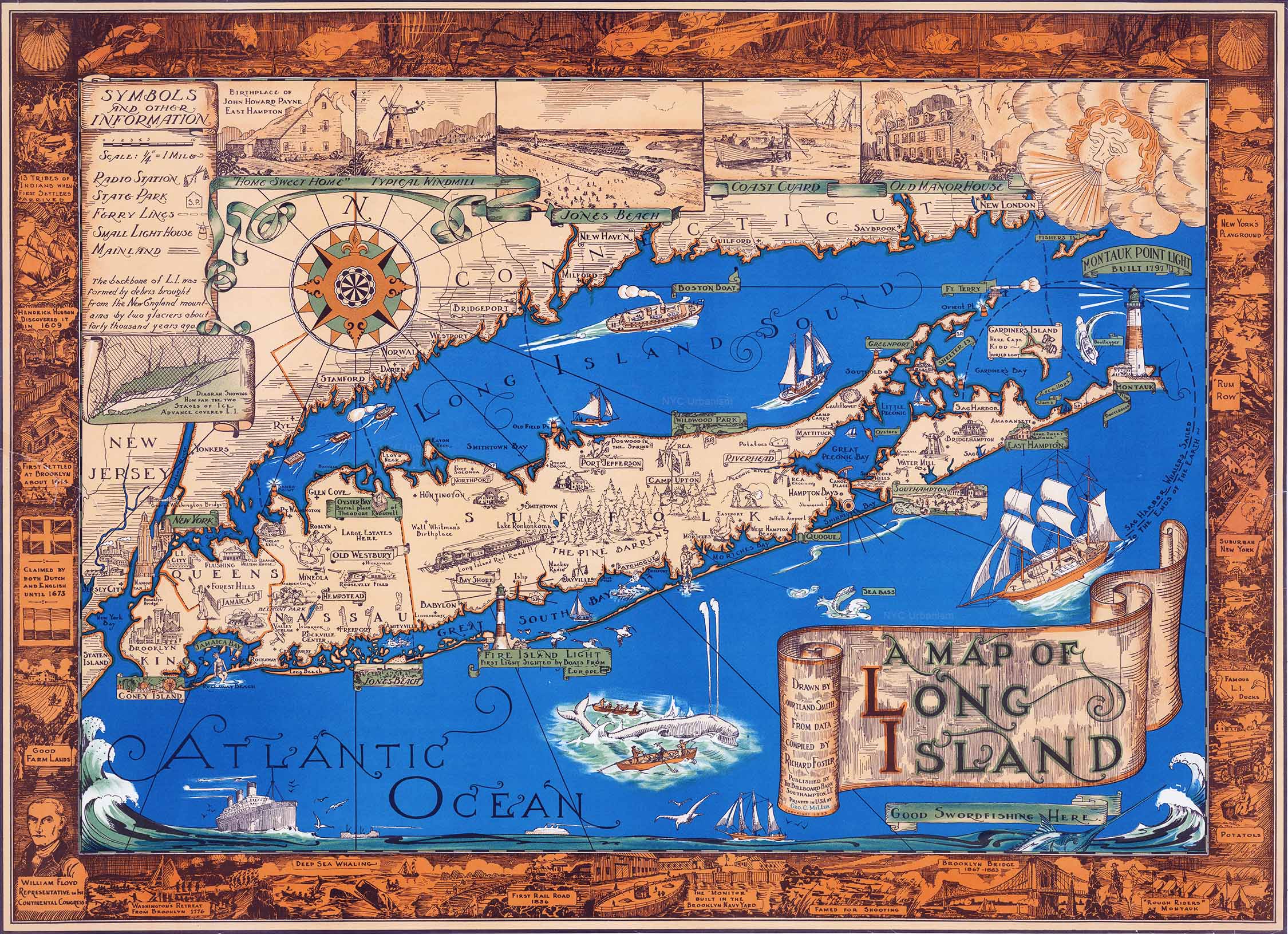
1933 Map of Long Island
from $19.99
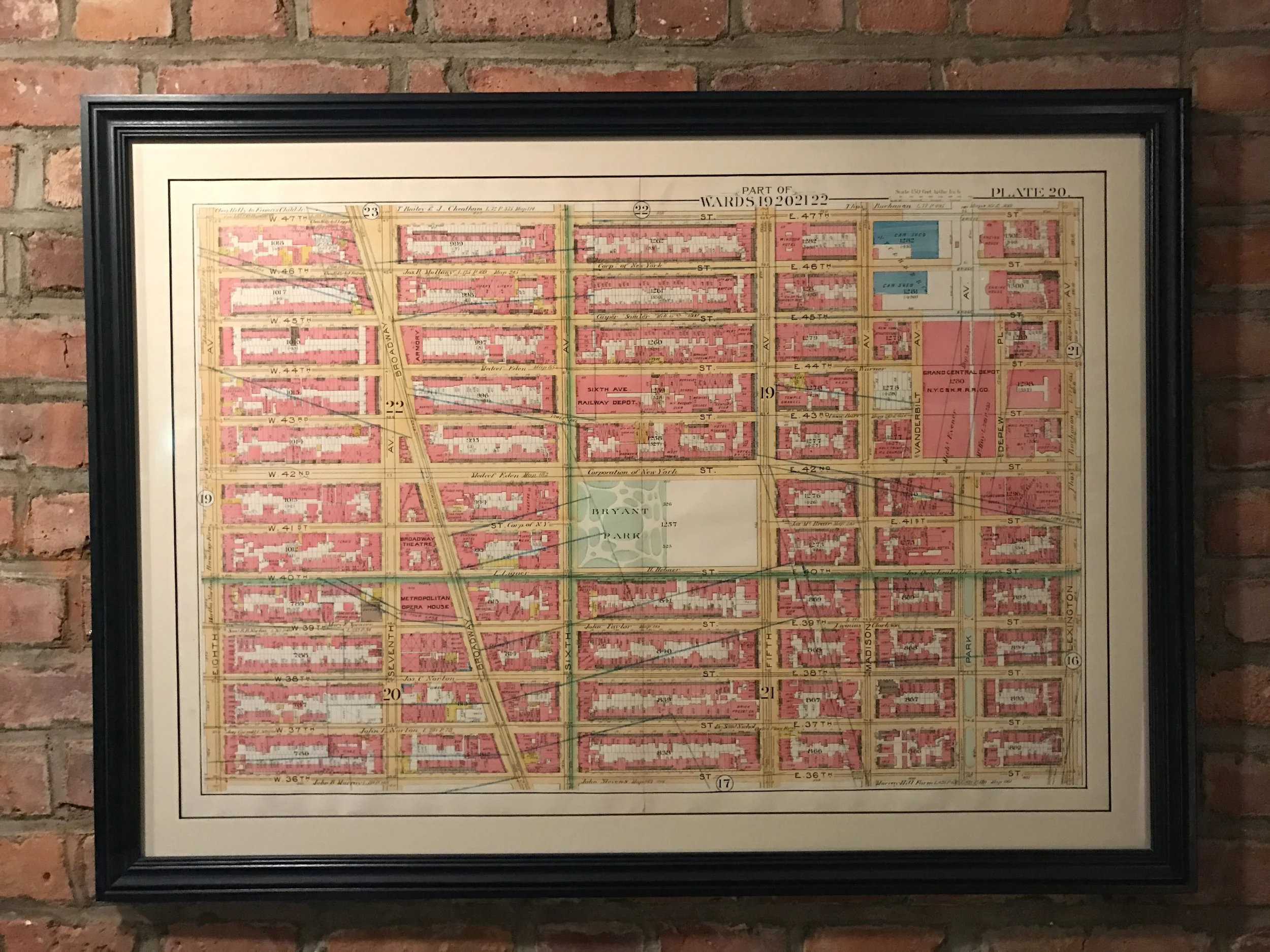
1891 Map of Midtown, Grand Central Depot, Bryant Park, Times Square.
from $35.00
1924 Routes of the Interborough Rapid Transit Company
from $12.99
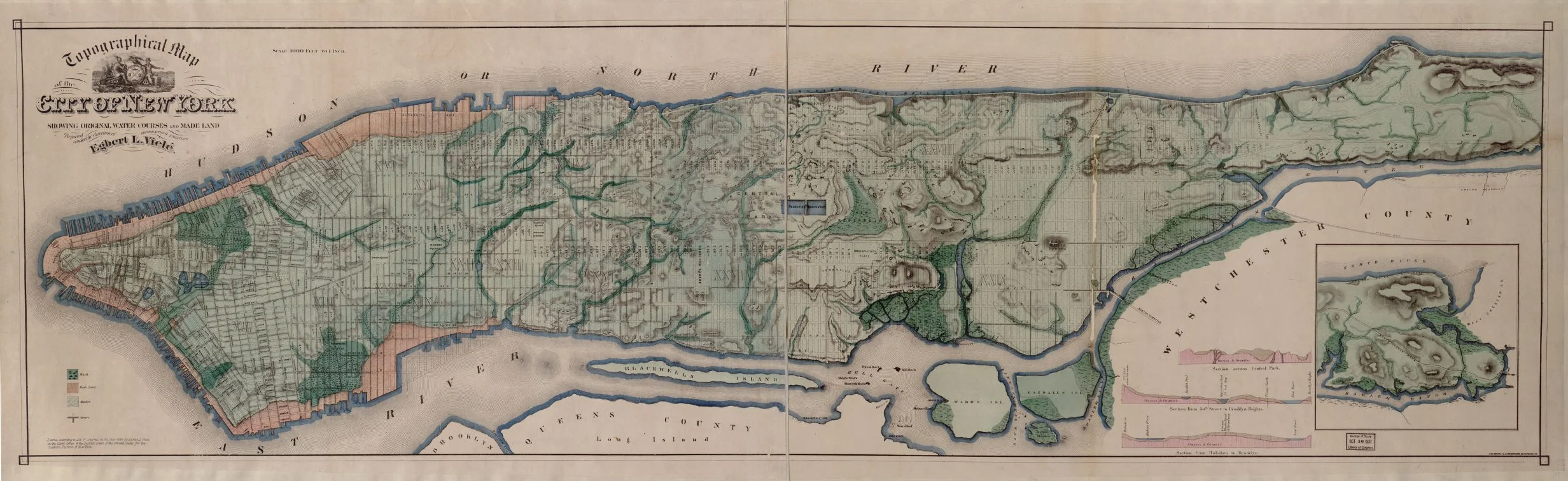
1865 Topographical map of the Manhattan
$22.99
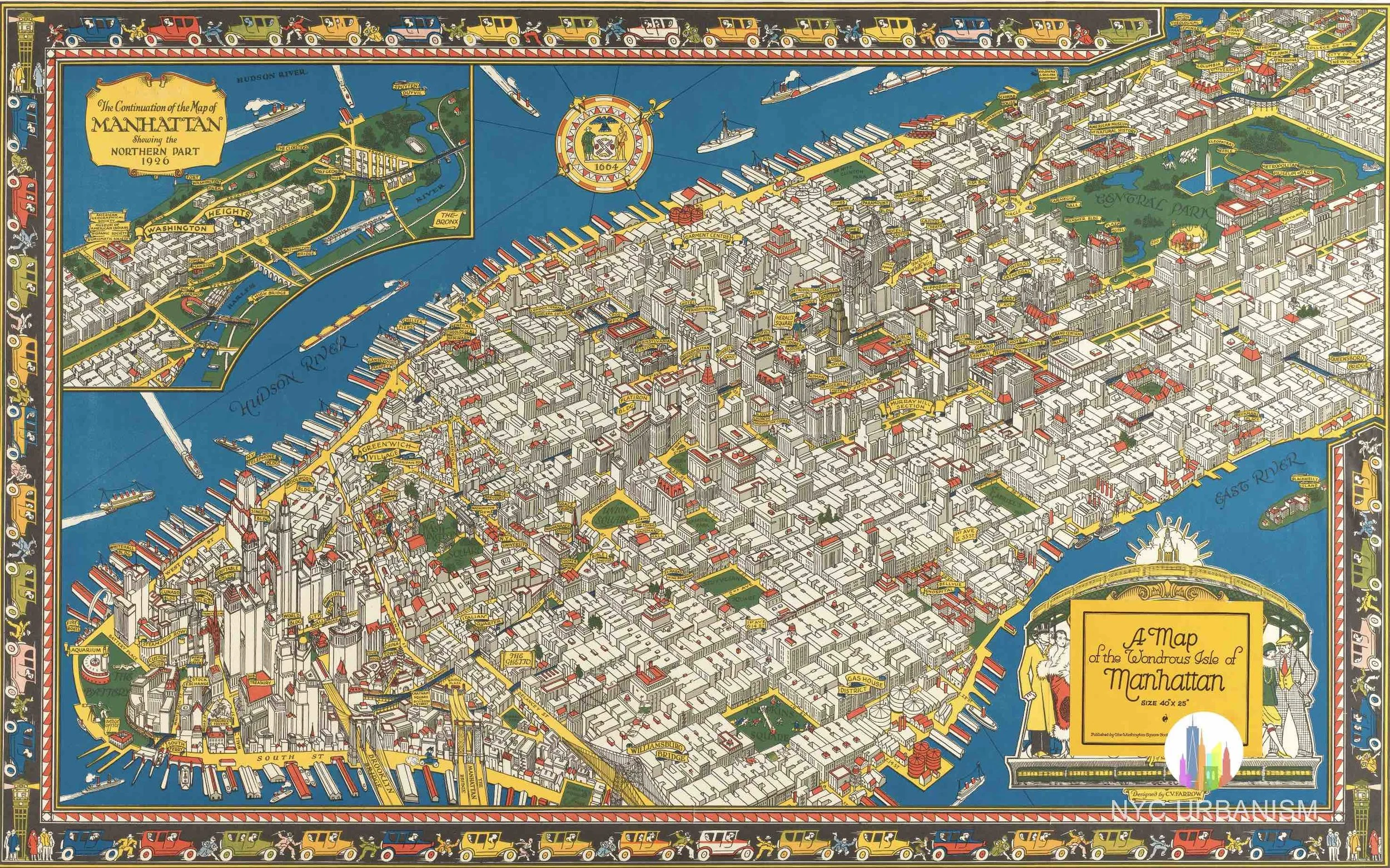
1926 Map of the Wondrous Isle of Manhattan
from $19.99
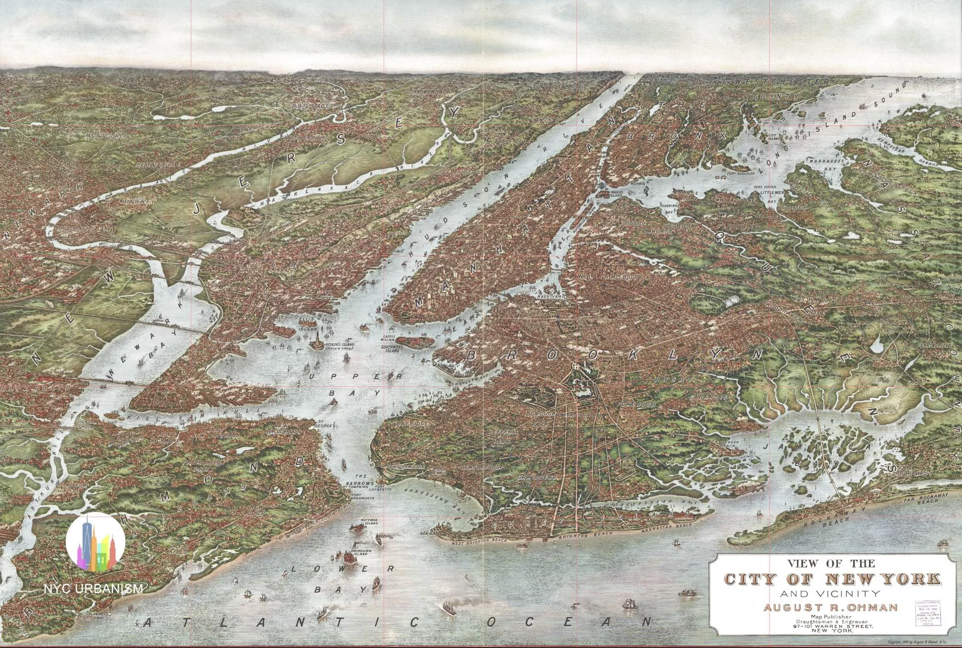
1907 Map of Greater New York City
from $19.99
1857 Map of New York City
from $19.99
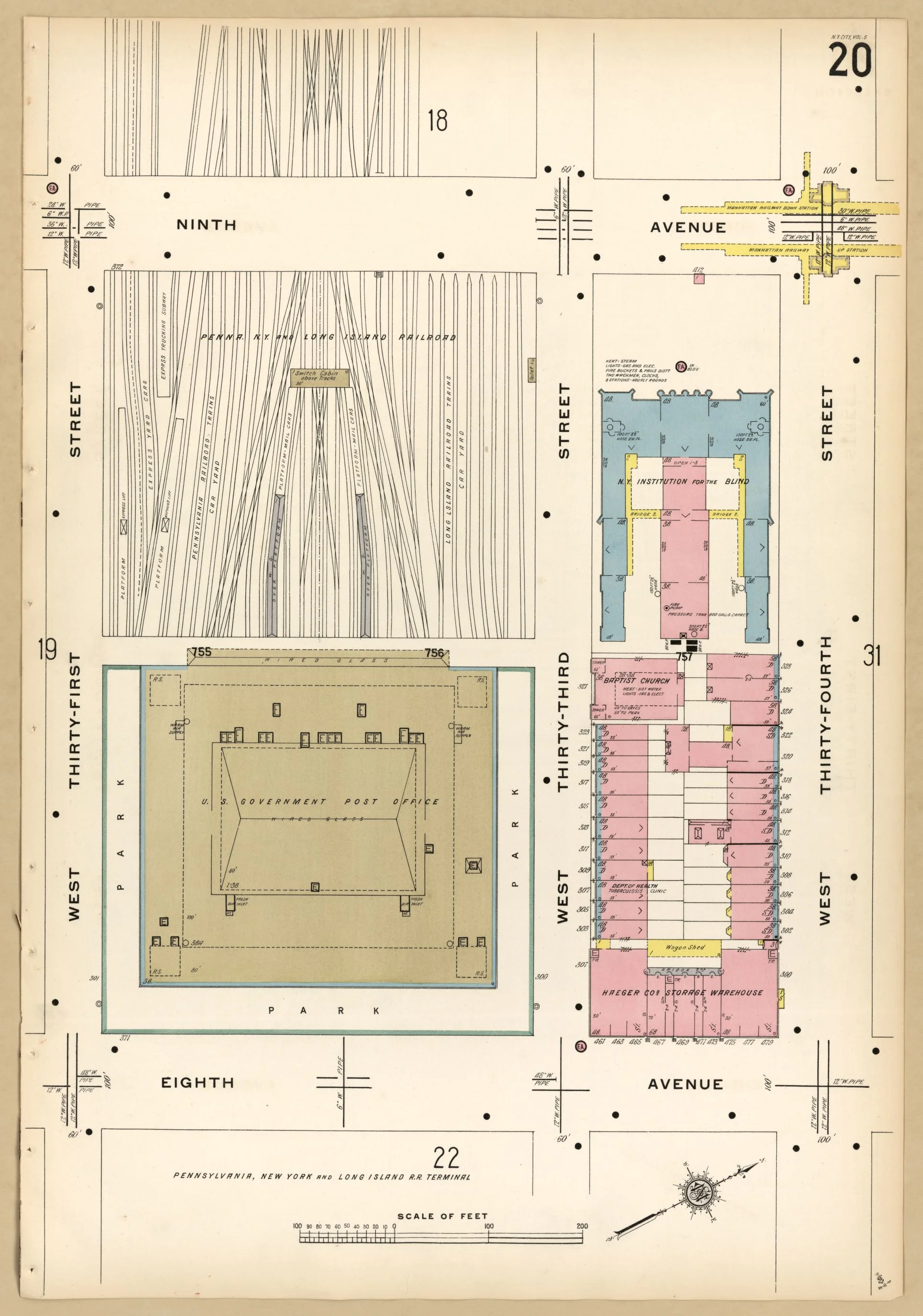
1911 Fire Insurance Map showing Penn Station
from $12.99
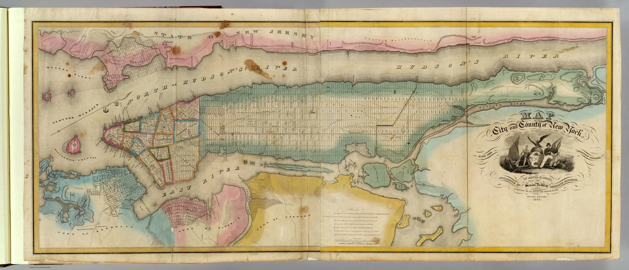
1832 David Burr Map of New York Print
from $19.99
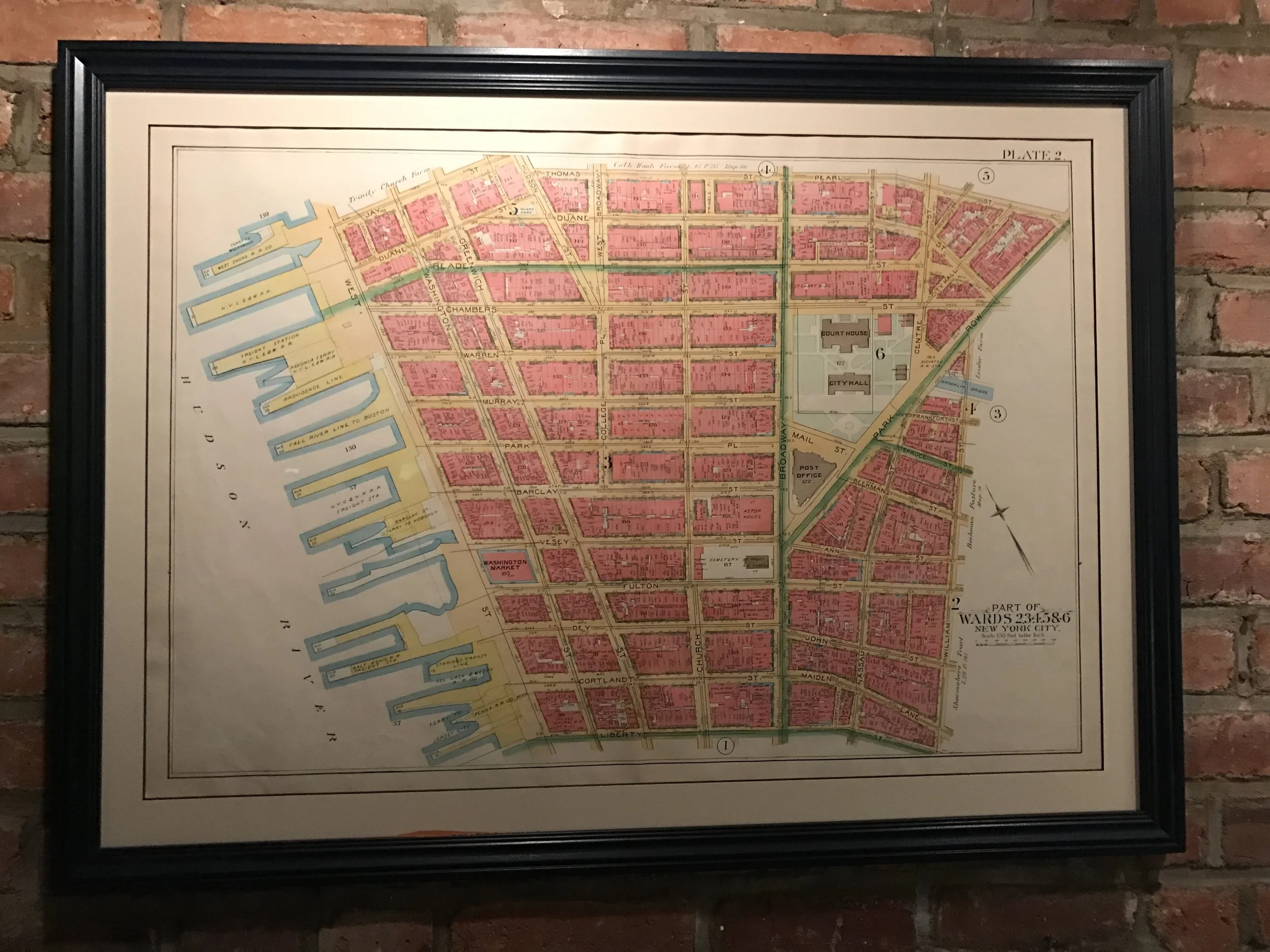
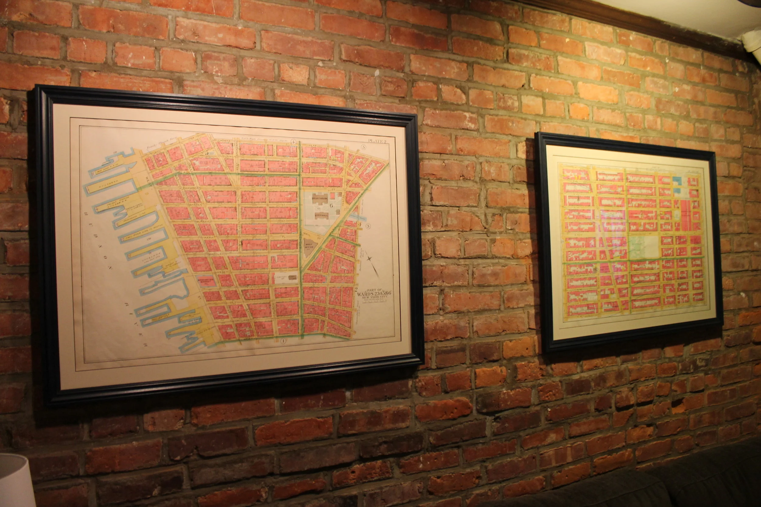
1891 Map of Lower Manhattan, City Hall, Trinity Church
from $35.00
1923 Map of the borough of Queens
from $19.99
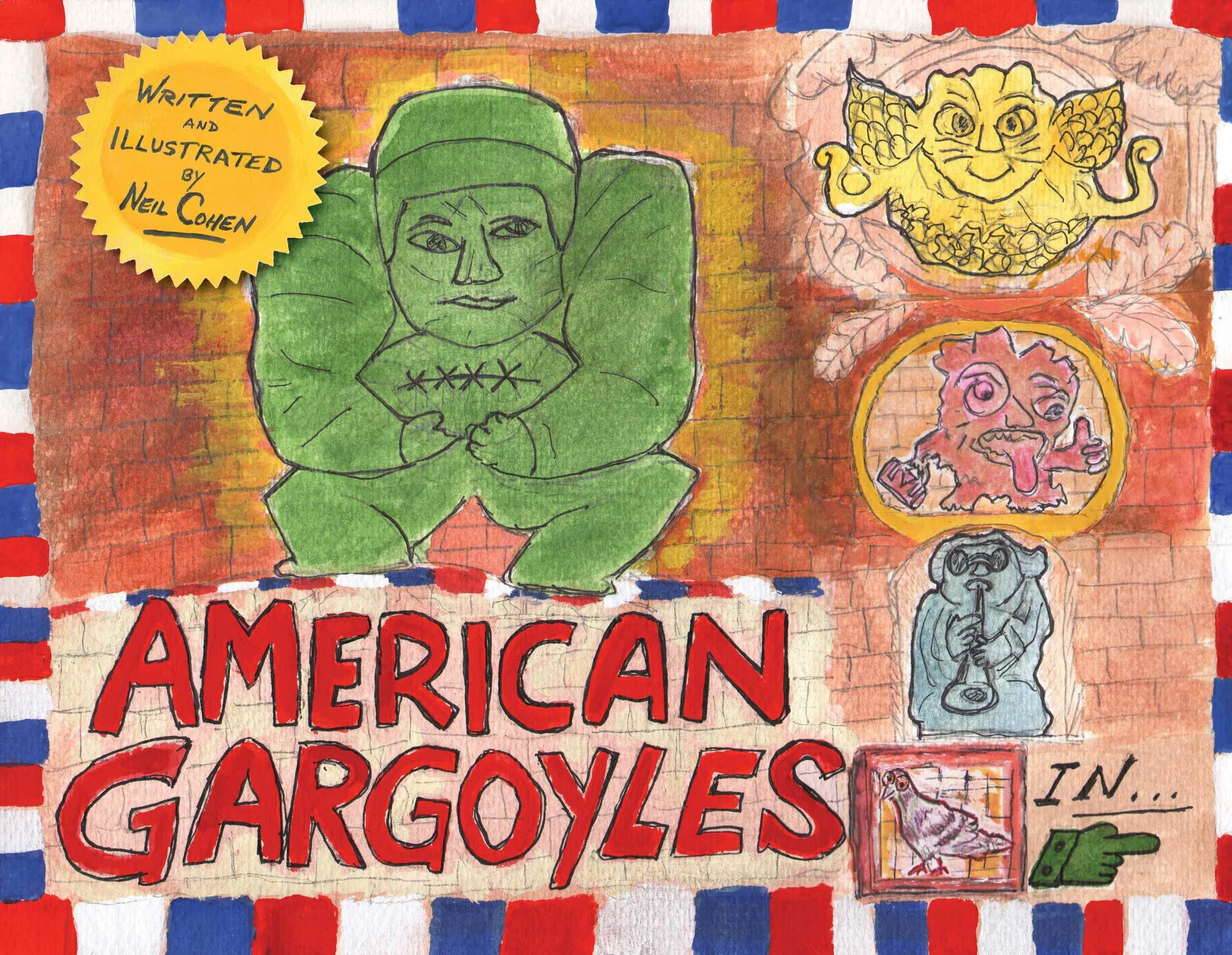
American Gargoyles
$19.99
1908 Map of Brooklyn
from $19.99
sale
1642 Dutch West India map of New Amsterdam
from $24.99
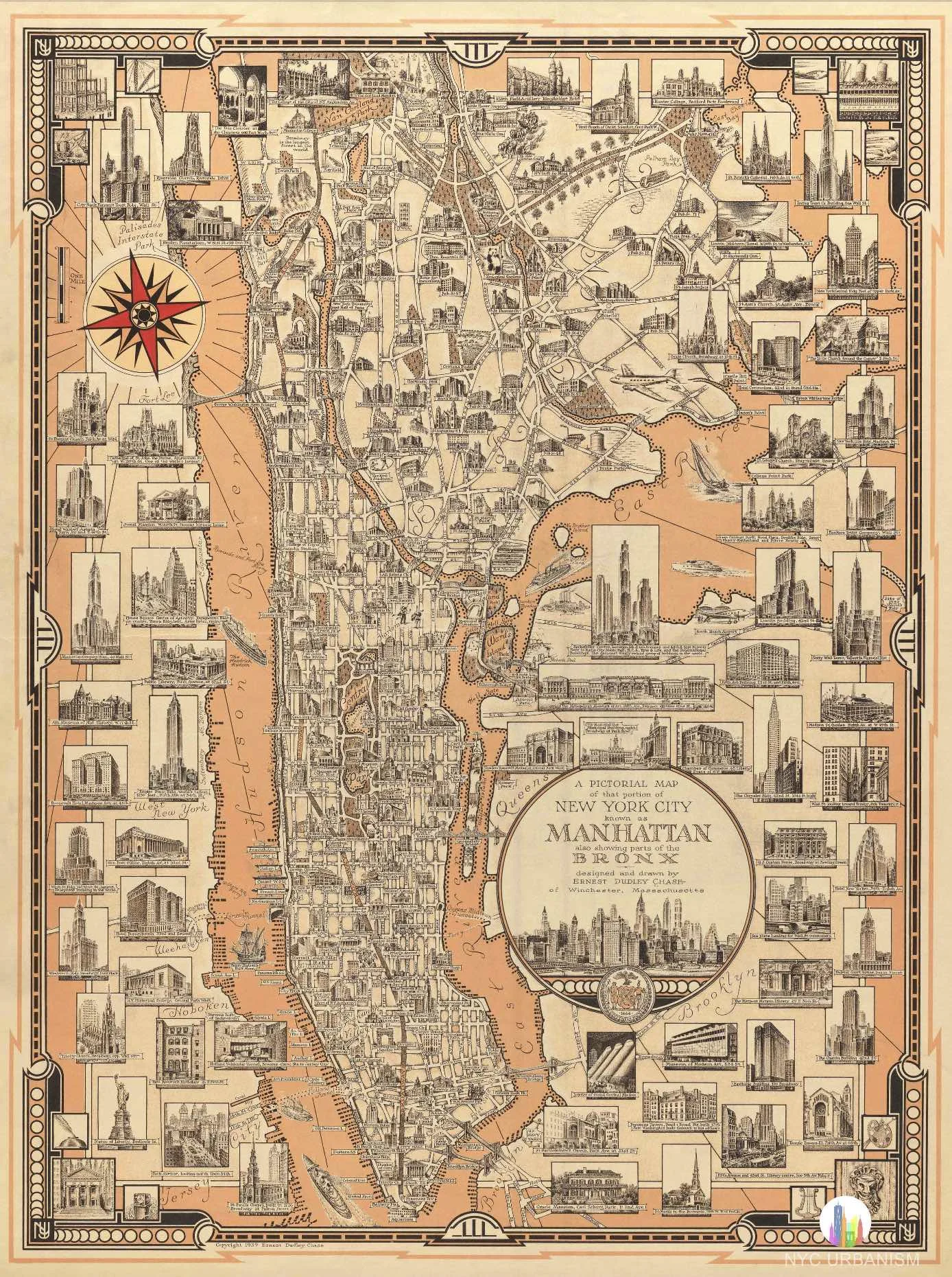
1939 Pictorial Map of Manhattan
from $22.99
sale
Historic Postcard Prints
Sale Price:
$14.99
Original Price:
$19.99
1932 Lower East Side Land Use Map
from $19.99
sale
Robert Moses' Proposed Expressway Map (13x19")
Sale Price:
$28.99
Original Price:
$29.99
1874 Brooklyn City Rail Road Company Map
from $19.99
sale
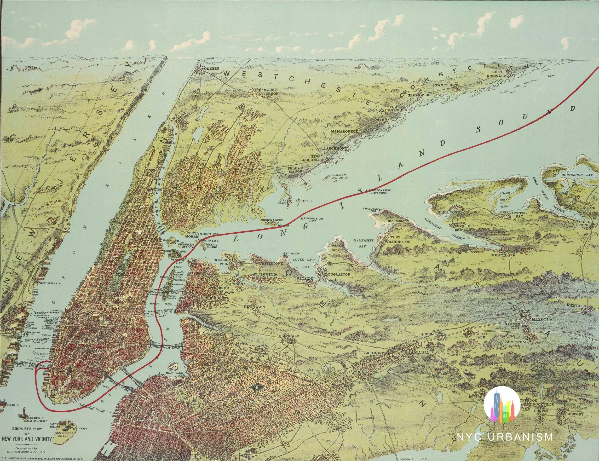
1912 Map of NYC Including Long Island and the Bronx
from $13.99
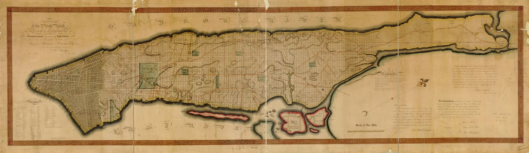
1811 Commissioners Plan Map (by William Bridges)
from $14.99
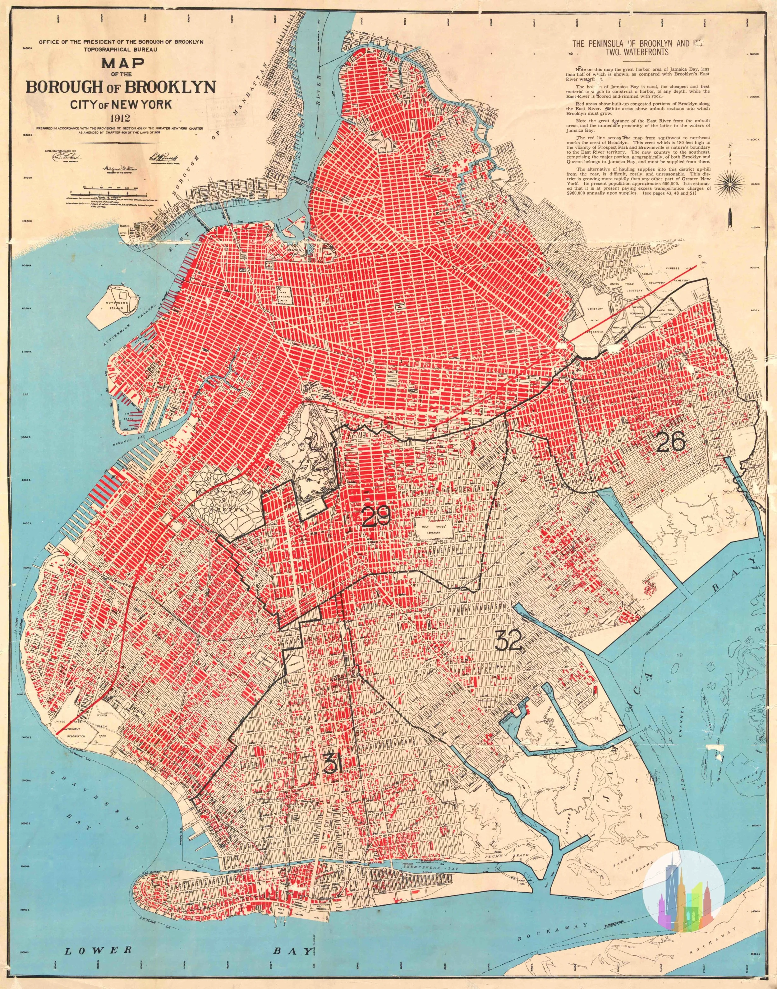
Brooklyn Map, 1912
from $19.99
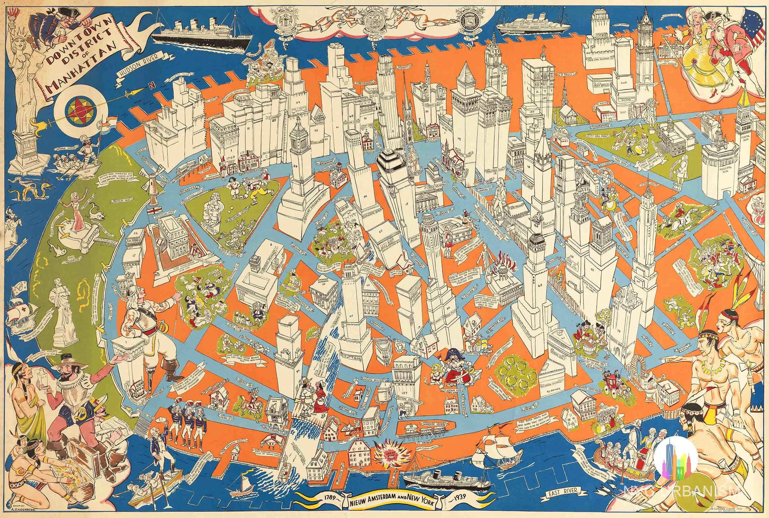
1939 Downtown District Map
from $19.99
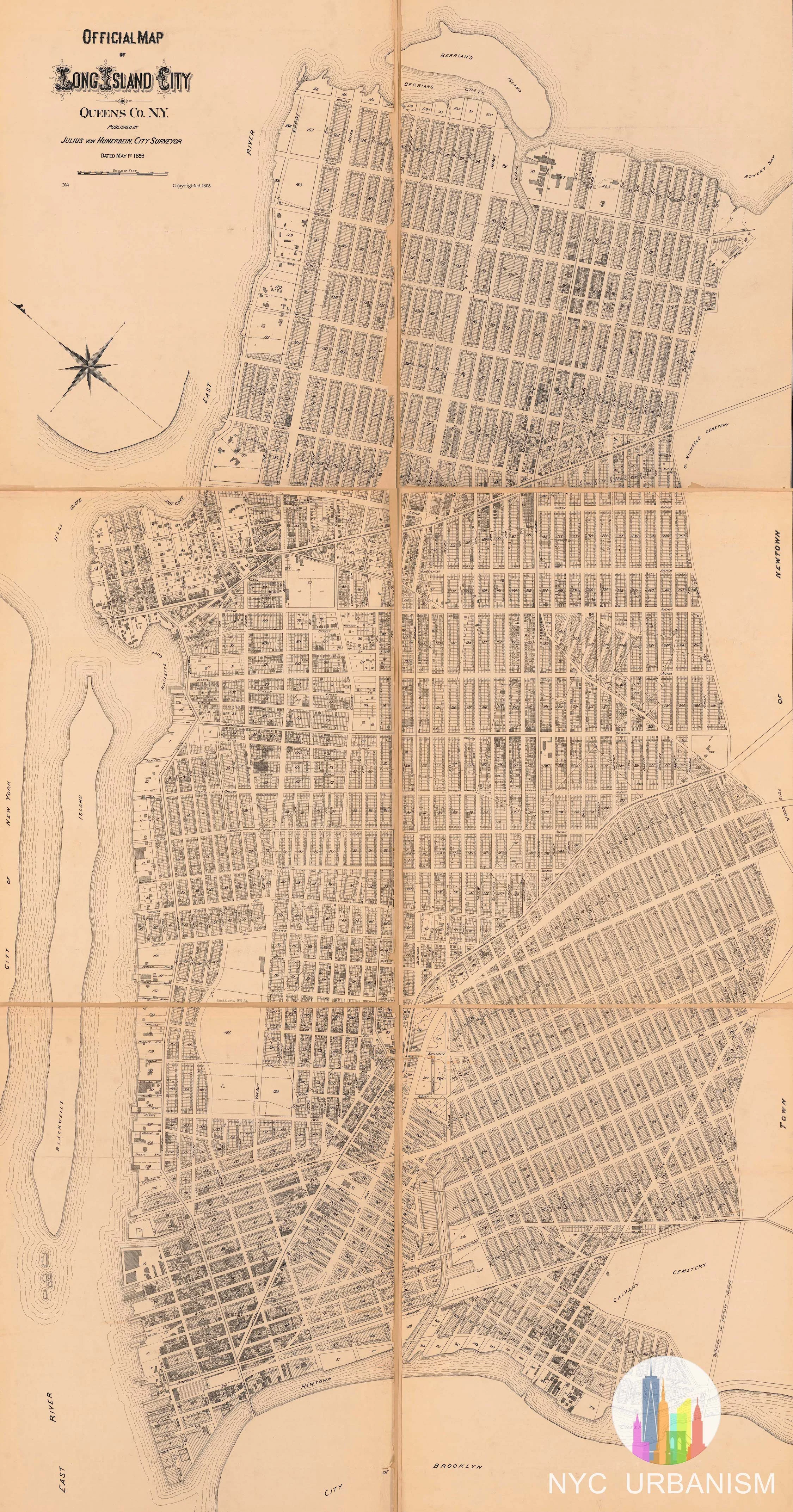
Official Map of Long Island City (1893)
$24.99
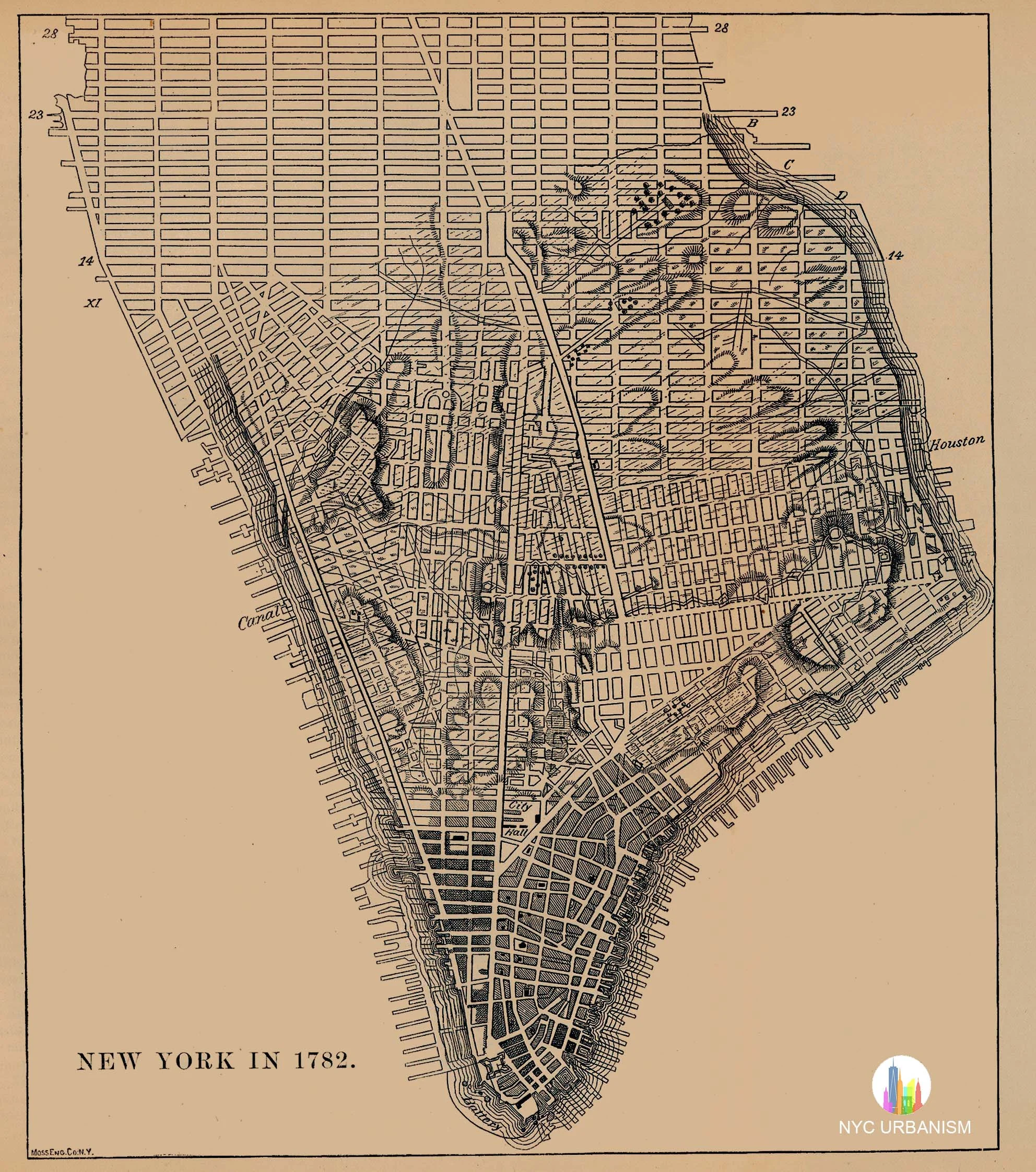
Maps of NYC Growth (1642-1782)
from $15.99
Lower Manhattan Expressway Map (1967)
from $15.99
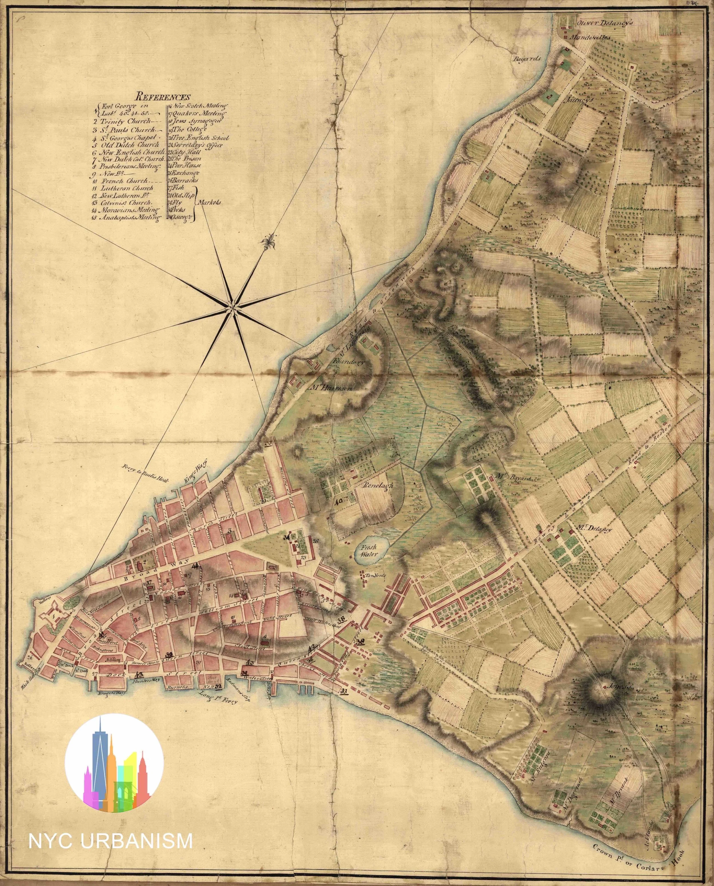
1776 Map of New York
from $19.99
1911 Land Map, Penn Station
from $16.99
Penn Station Map
from $24.99
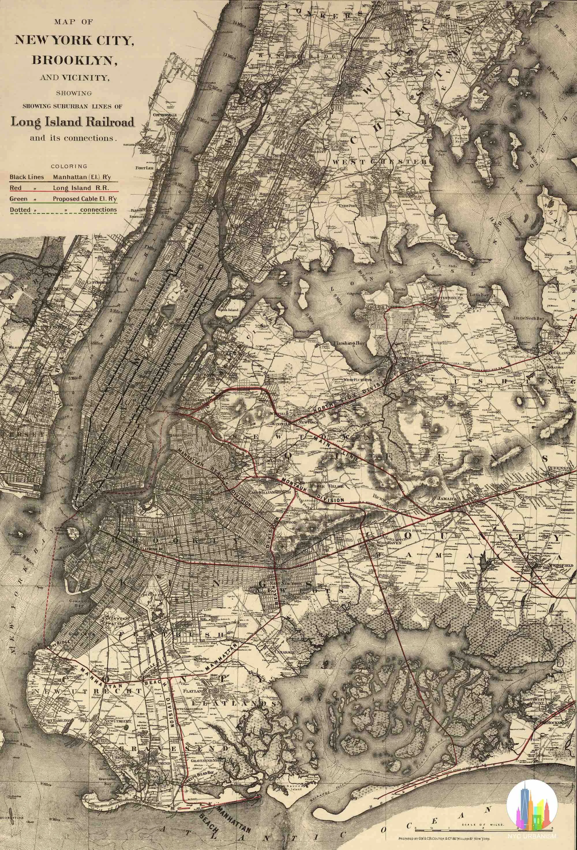
Long Island Railroad Map (1885)
from $13.99
sale
1886 Map of Brooklyn, Queens, Long Island
Sale Price:
$17.99
Original Price:
$21.99
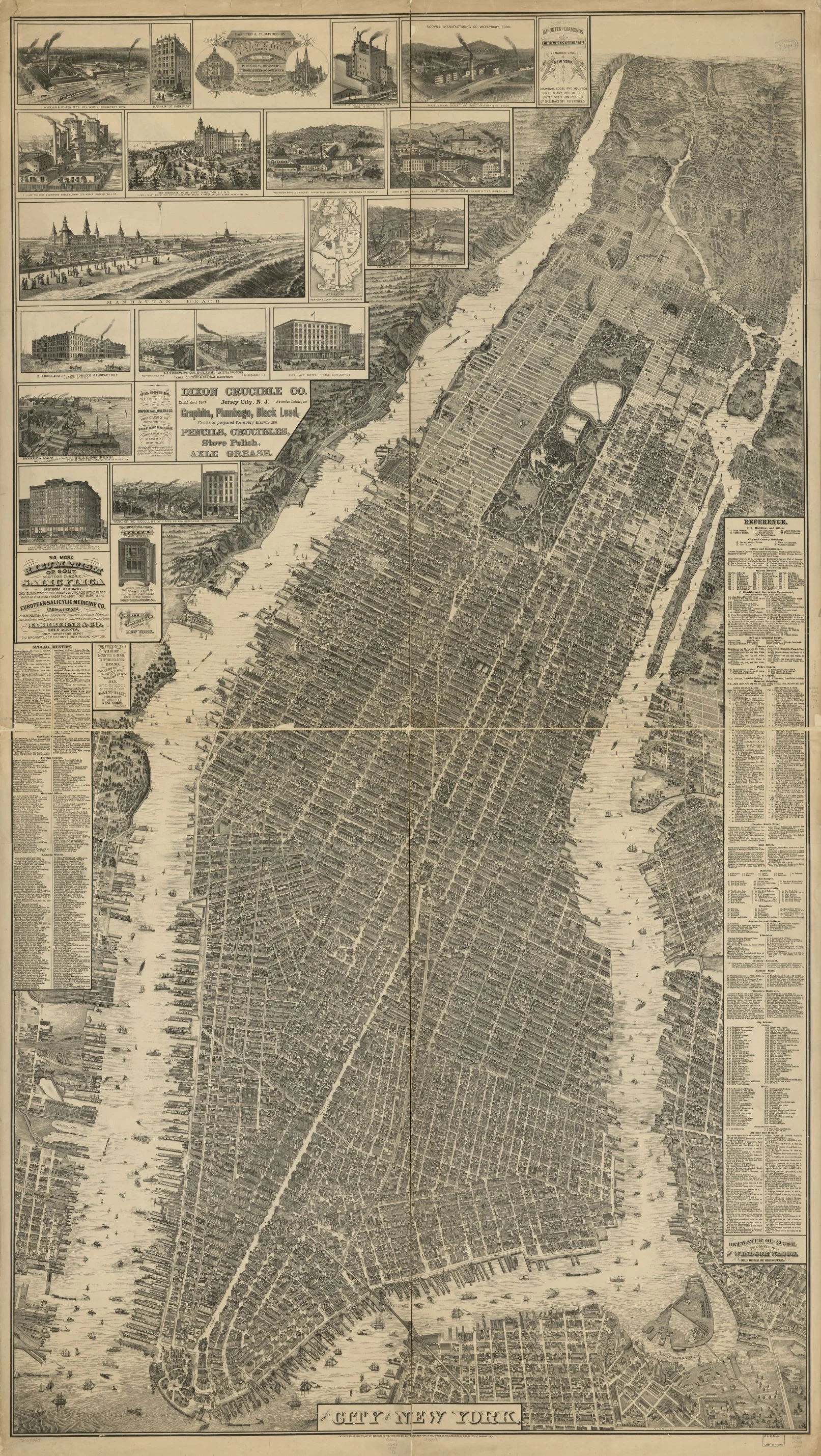
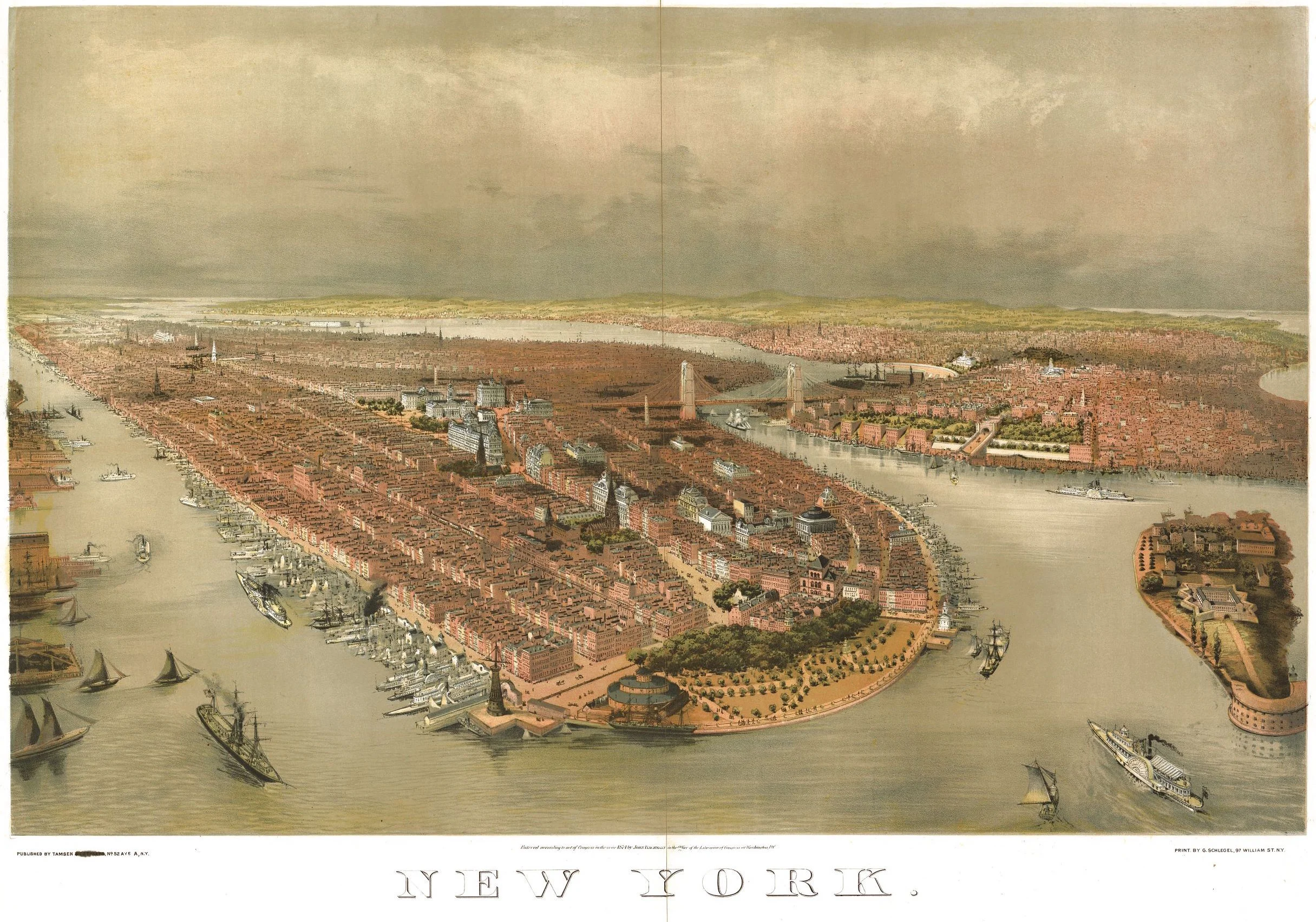
Bird's Eye View of NYC, 1874
from $11.99
1781 Map of Manhattan and Brooklyn
from $19.99
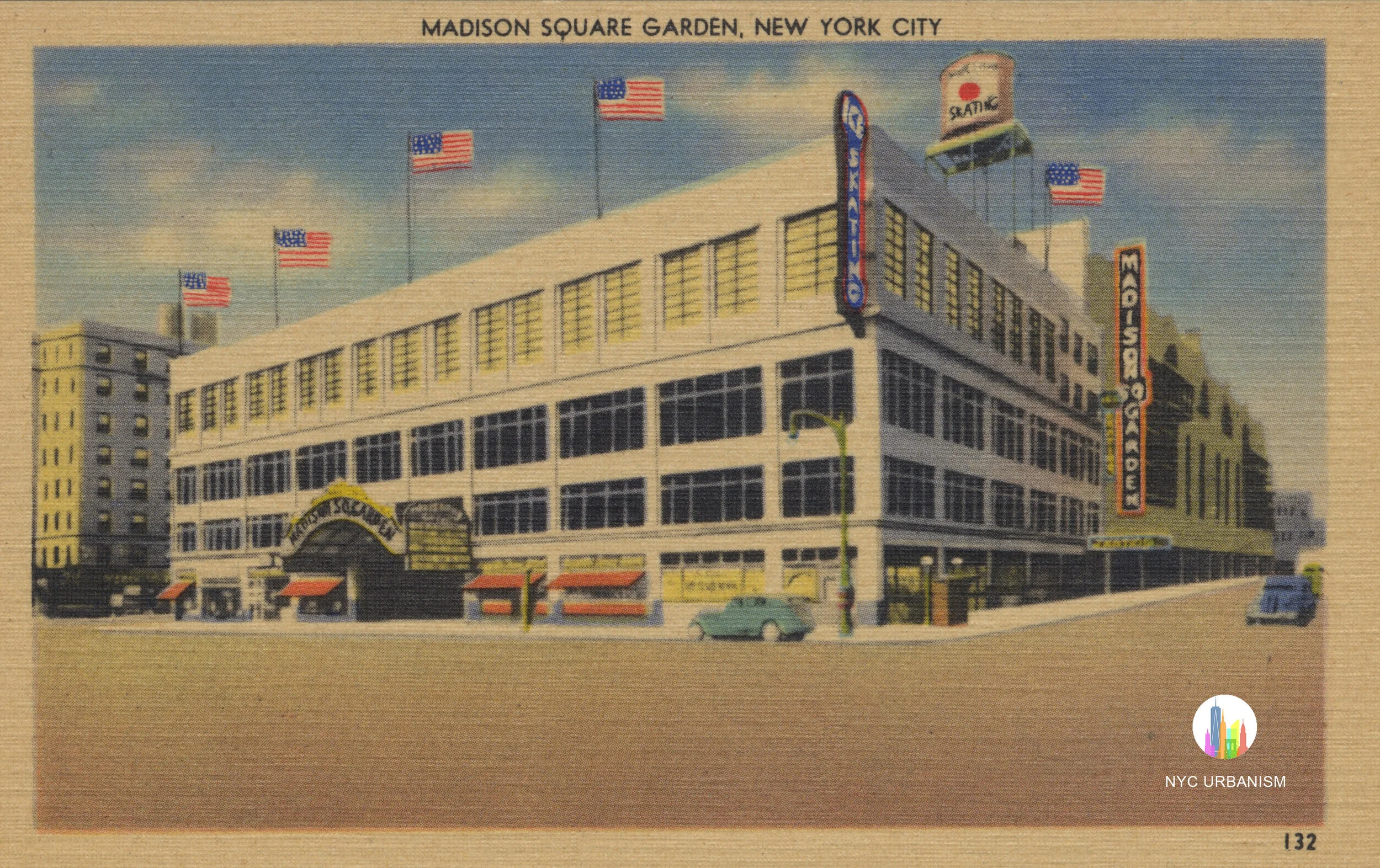
Madison Square Garden III
$19.99
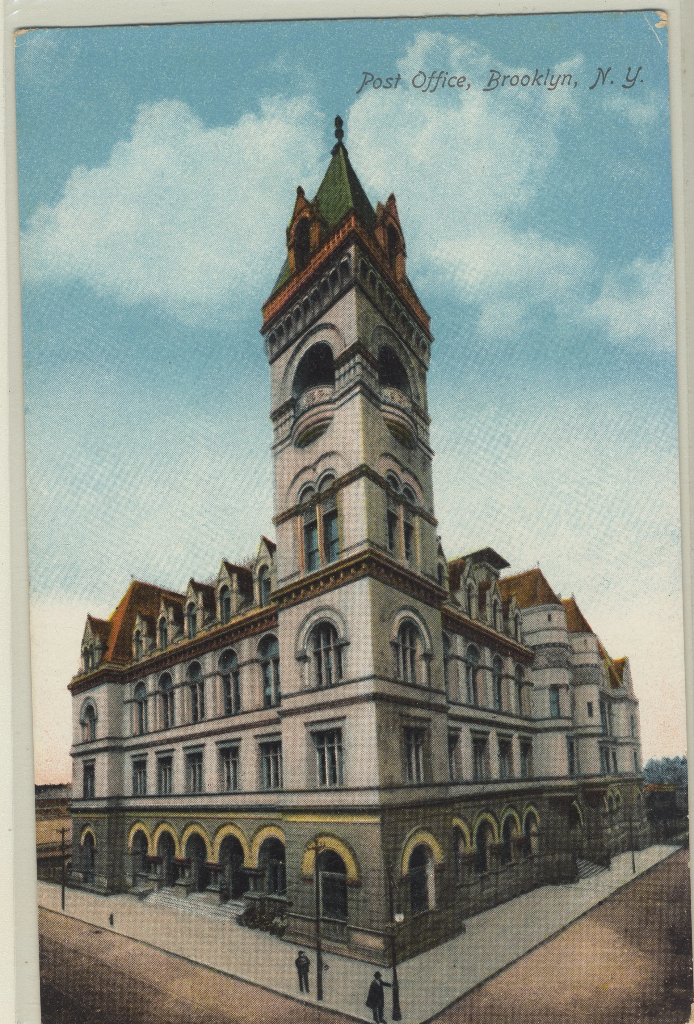
Brooklyn Post Office Postcard Print
from $12.00
Central Park, 1864
from $19.99
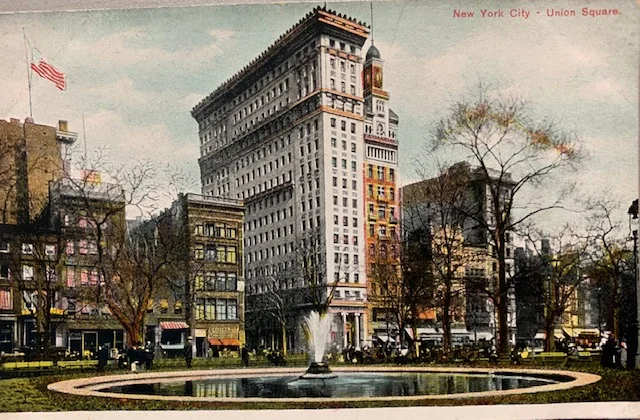
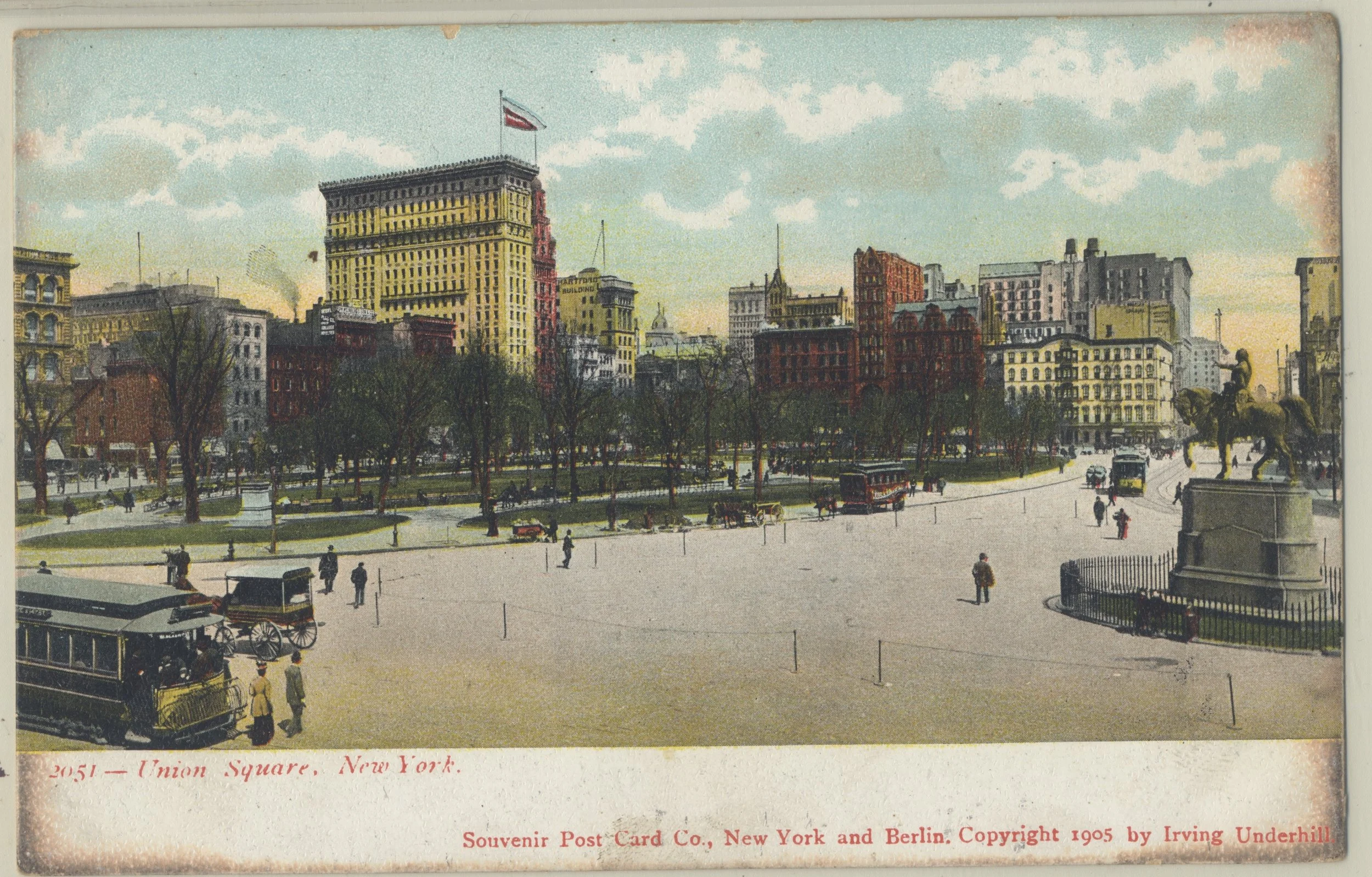
Union Square Postcard Print
from $12.00
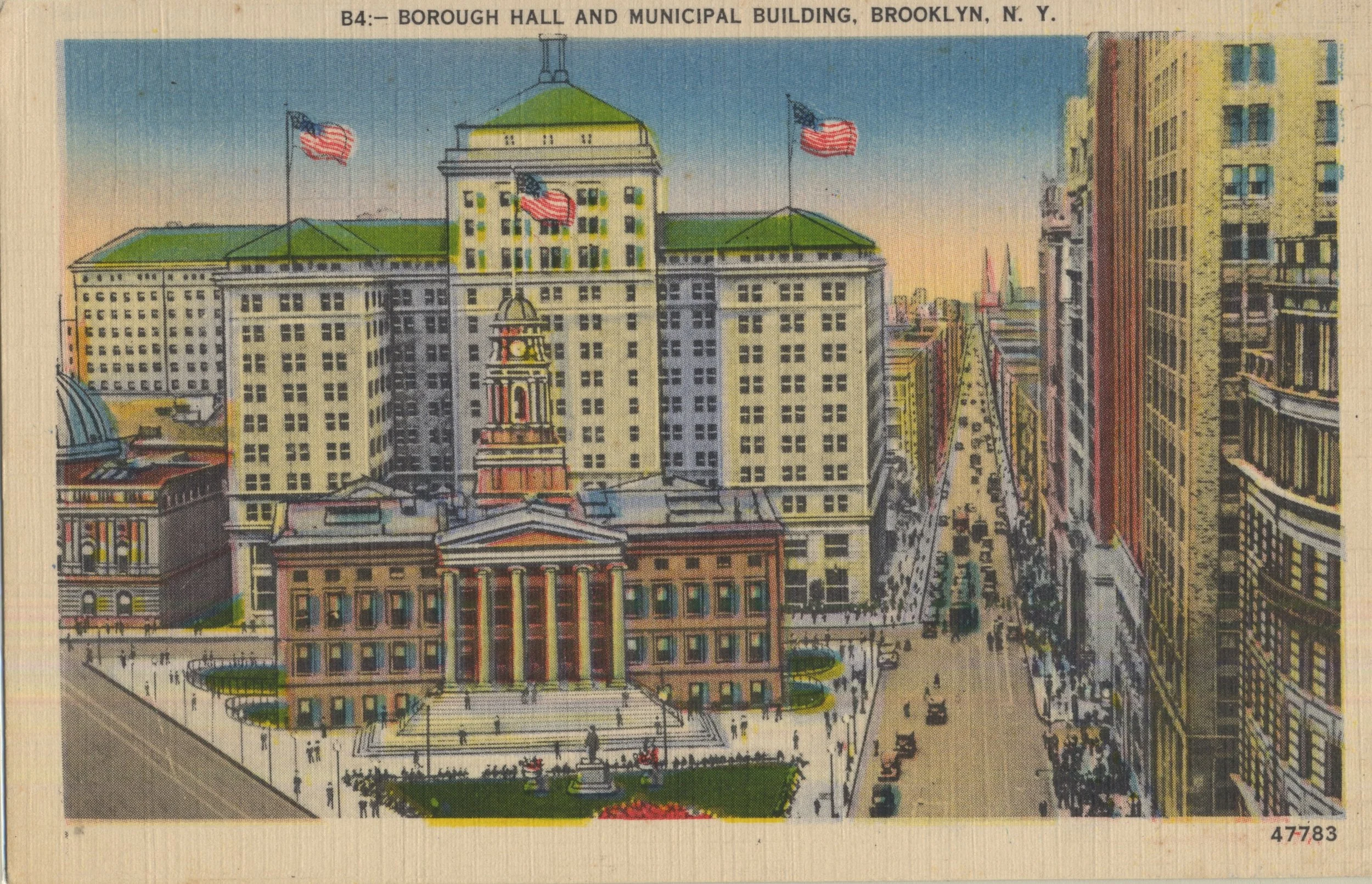
Brooklyn Borough Hall and the Municipal Building Postcard Print
from $12.00
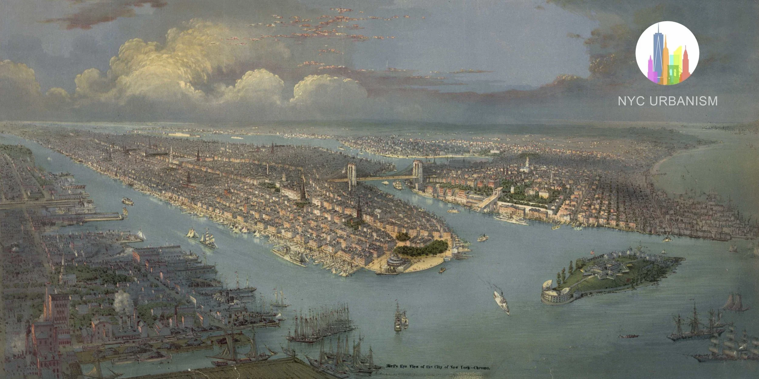
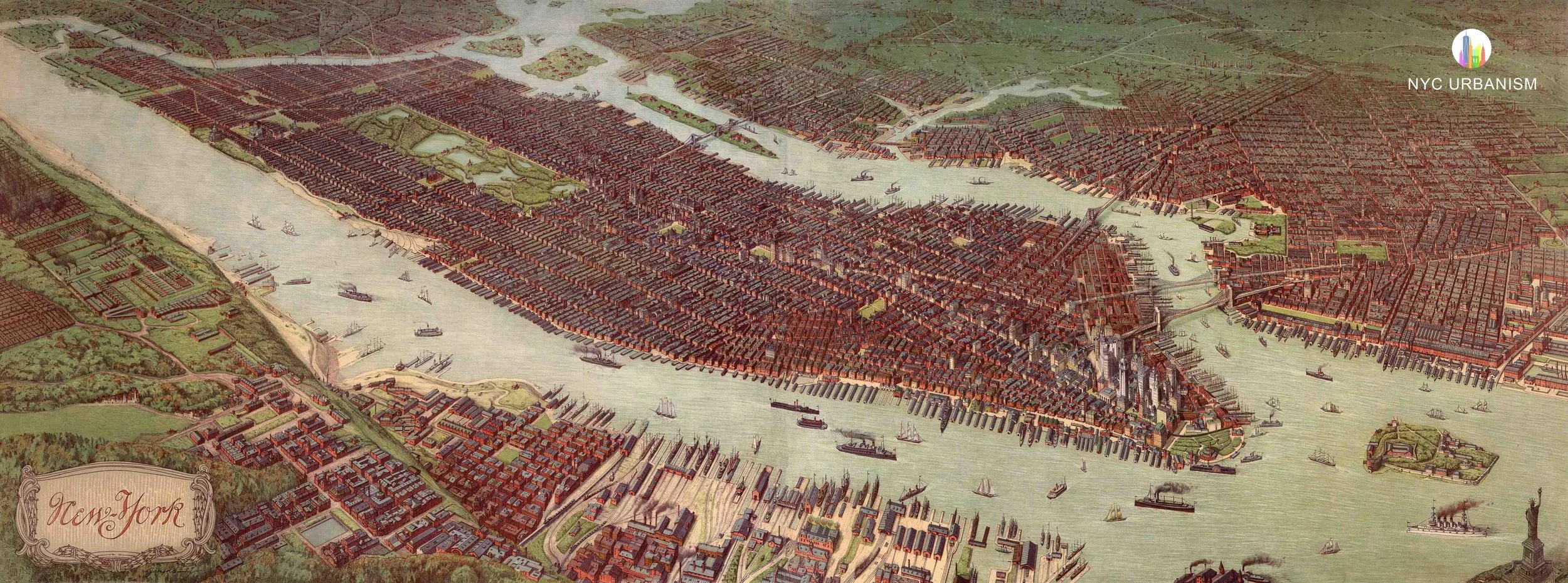
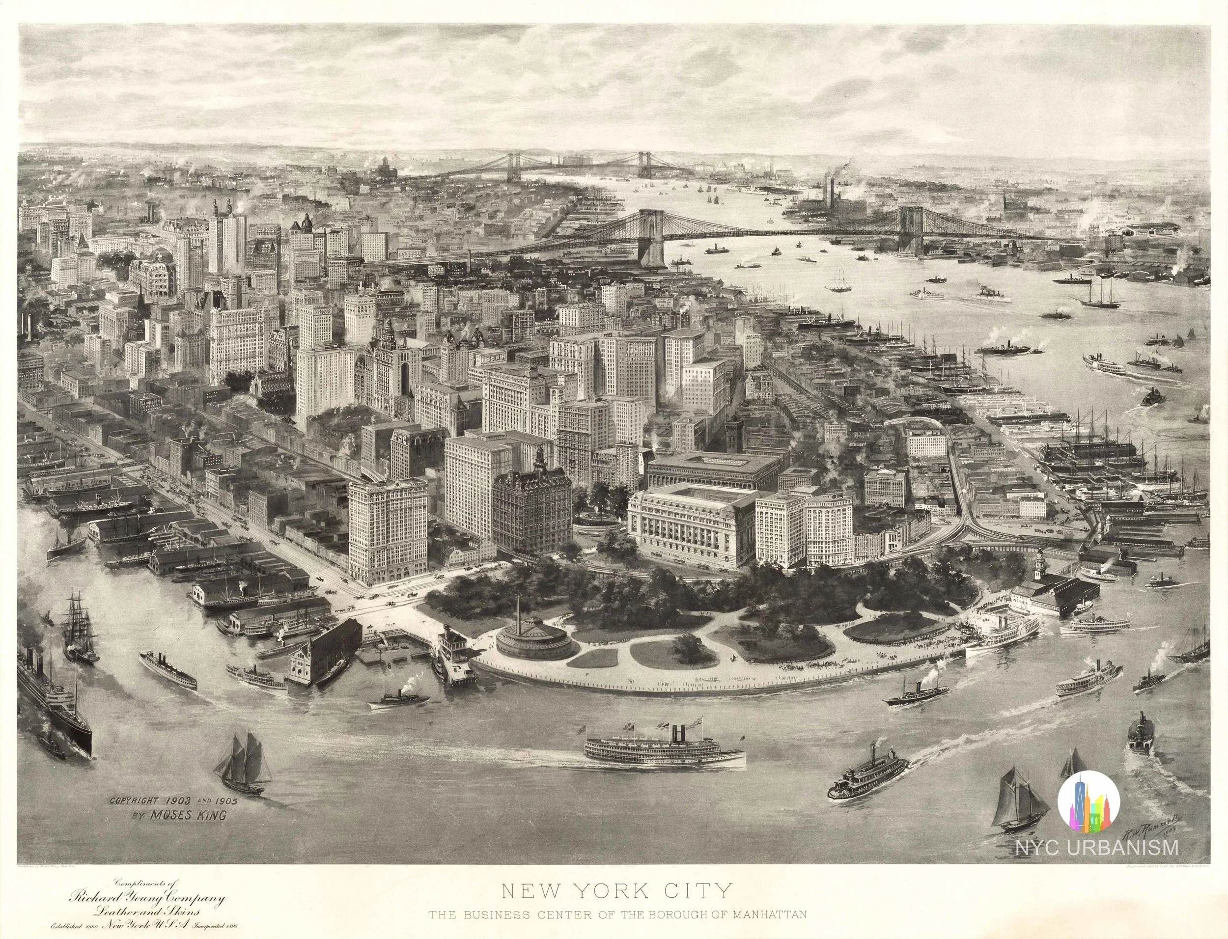
1880s Bird's-Eye View of the City of New York
from $16.99
sale
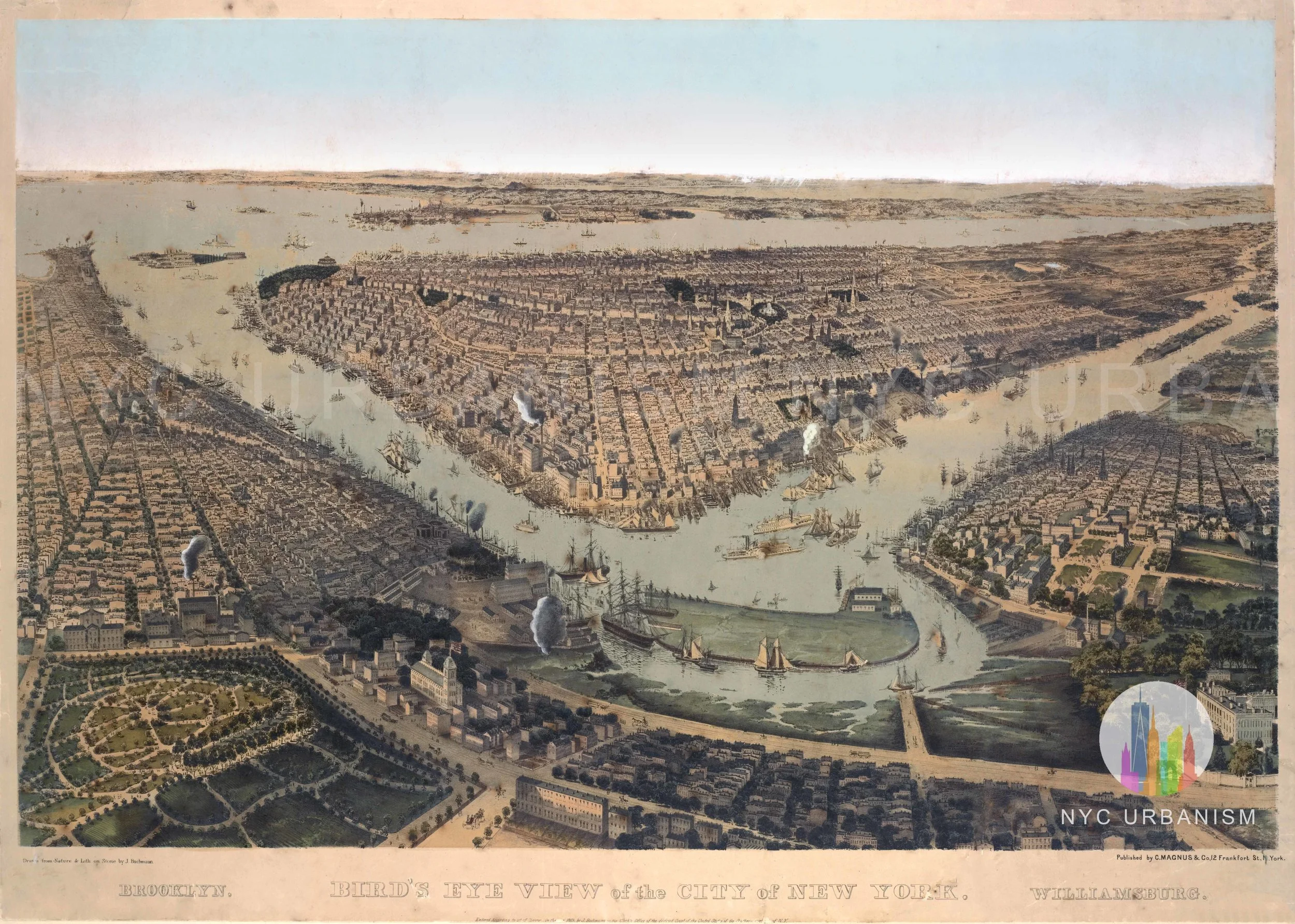
1859 View of New York, Brooklyn and Williamsburg
from $19.99
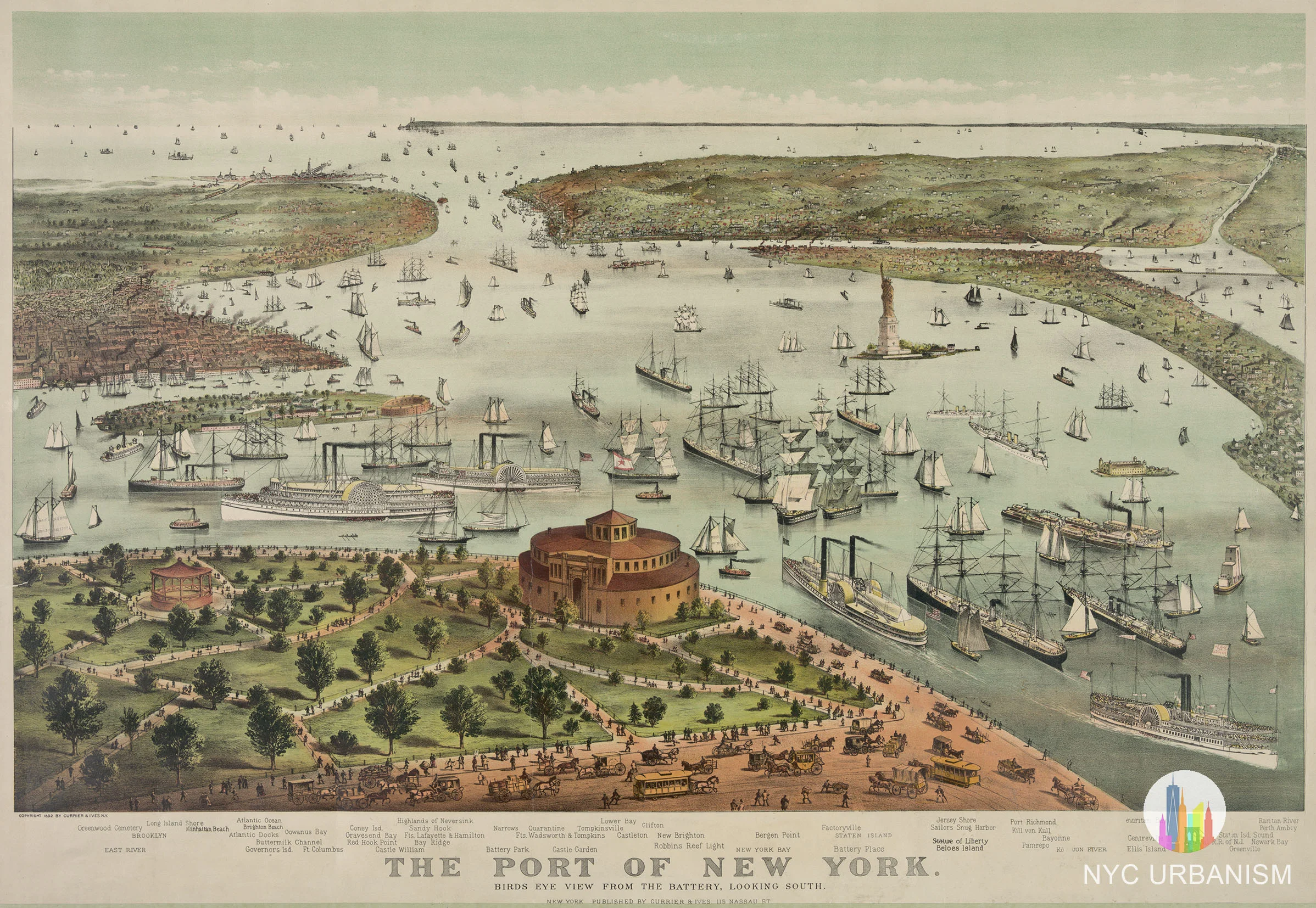
Port of New York, 1892
from $14.99
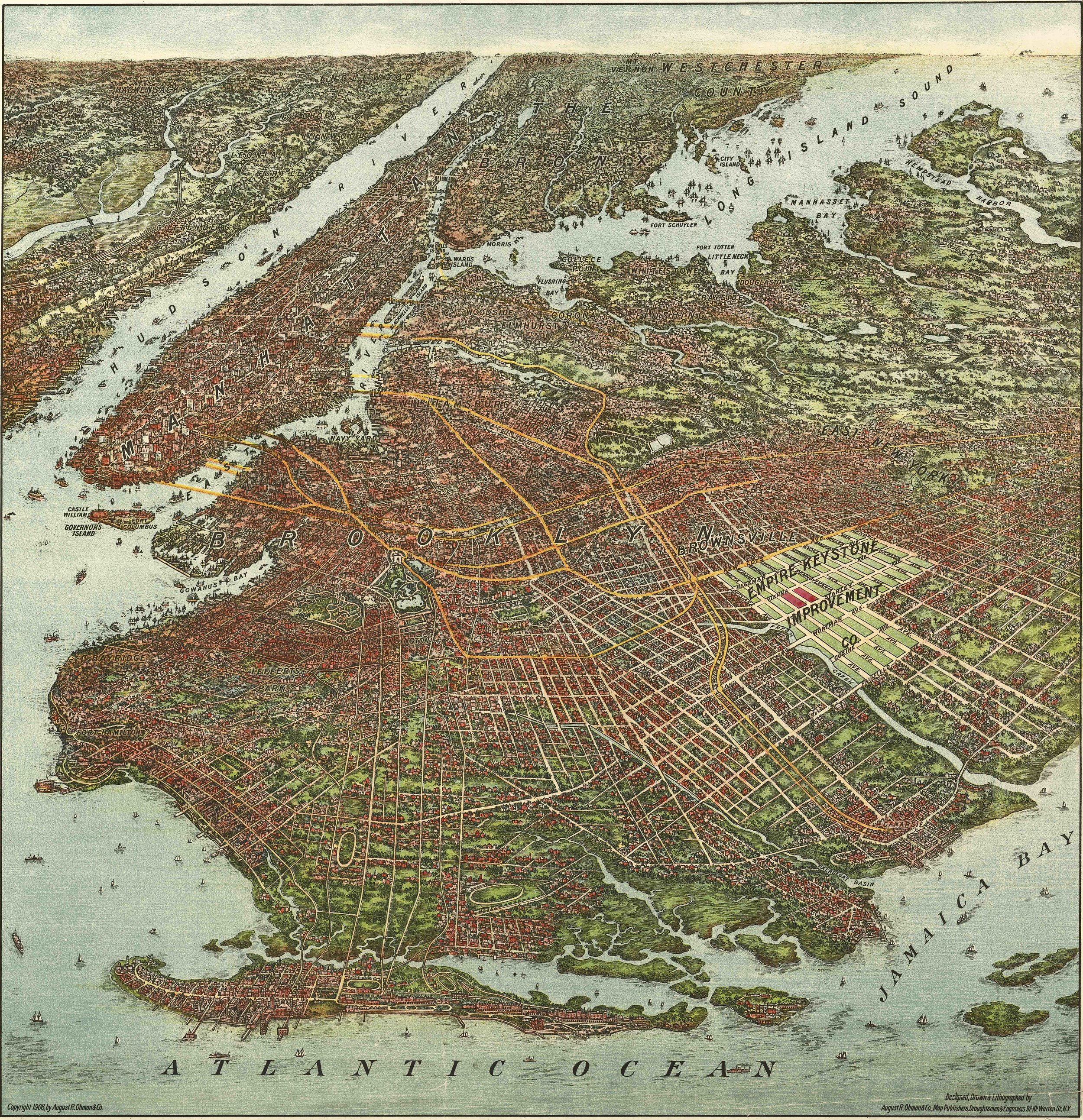
1908 Bird's-Eye View
from $19.99
sold out
56 Leonard St
$30.00
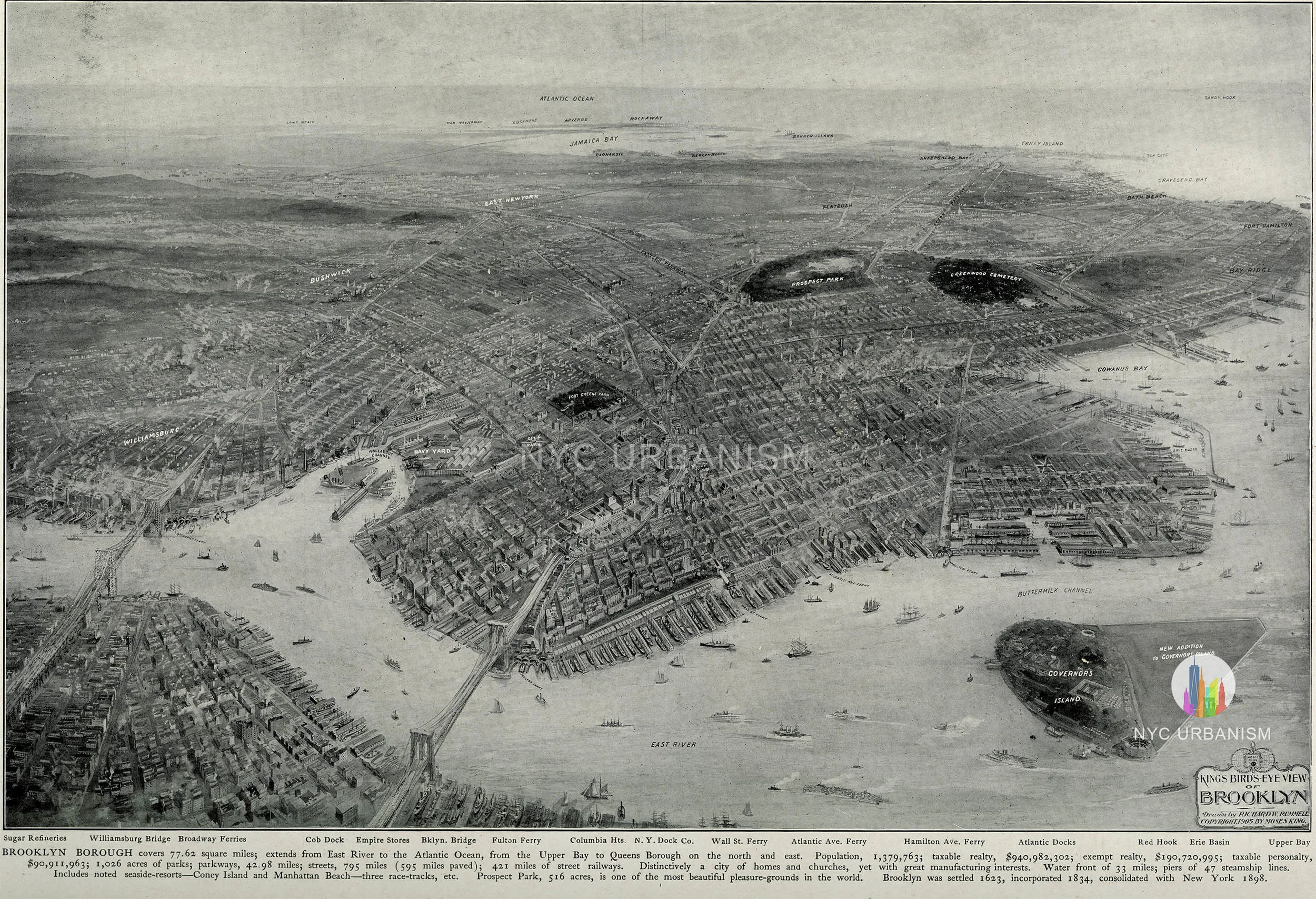
1905 Bird's-Eye View of Brooklyn
from $19.99
2 World Trade Center
$30.00
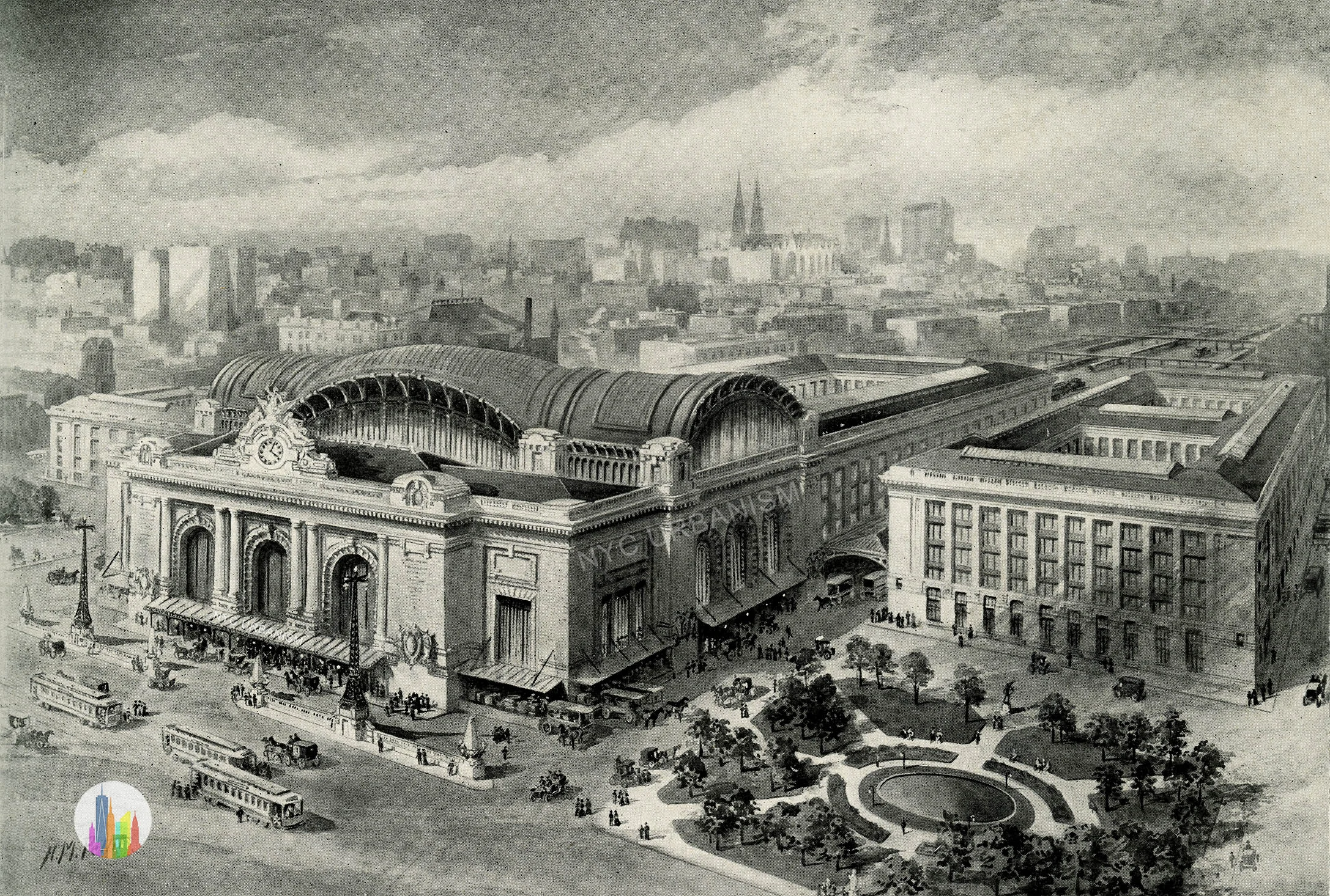
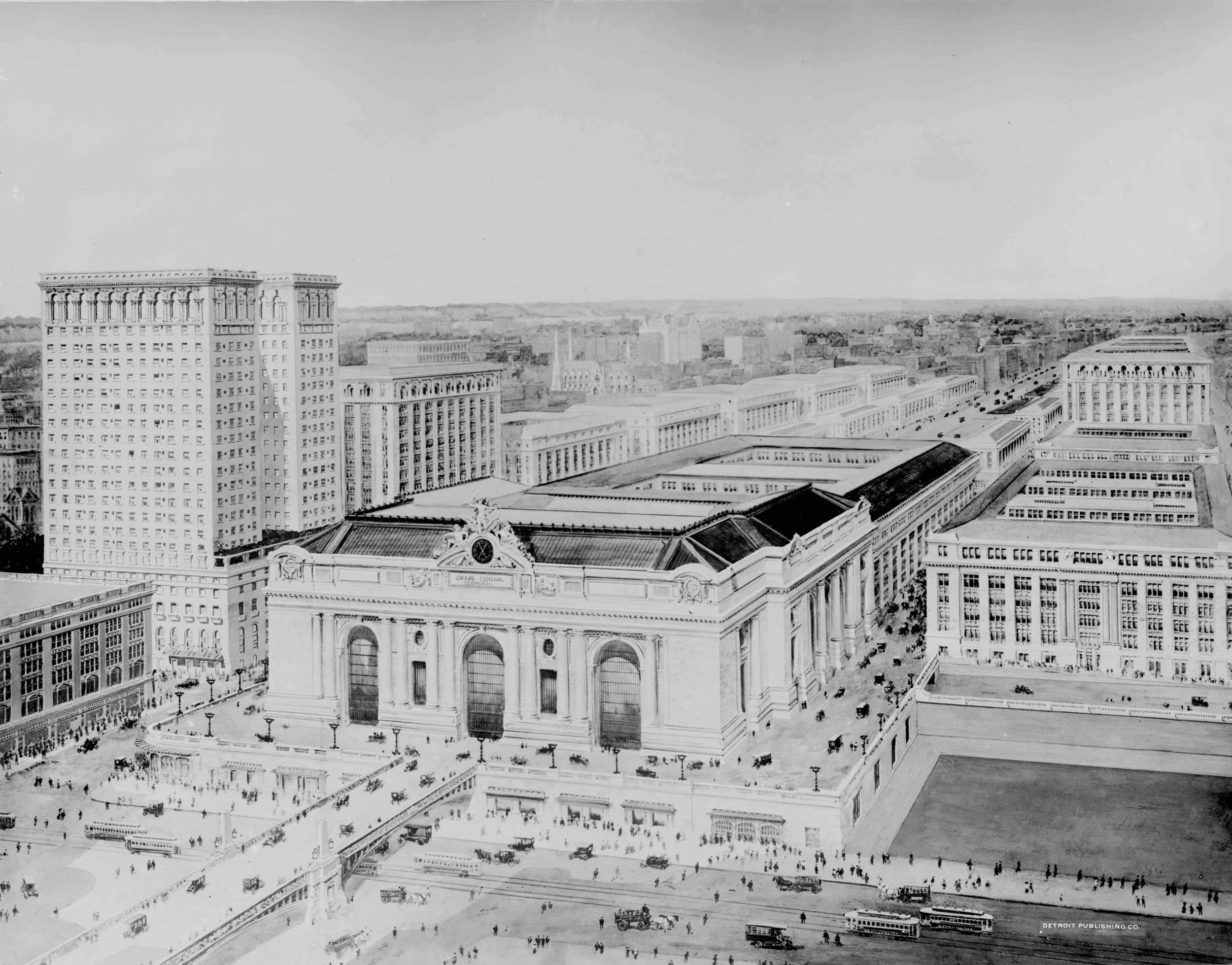
Grand Central Terminal - Early Design (1905)
from $19.99
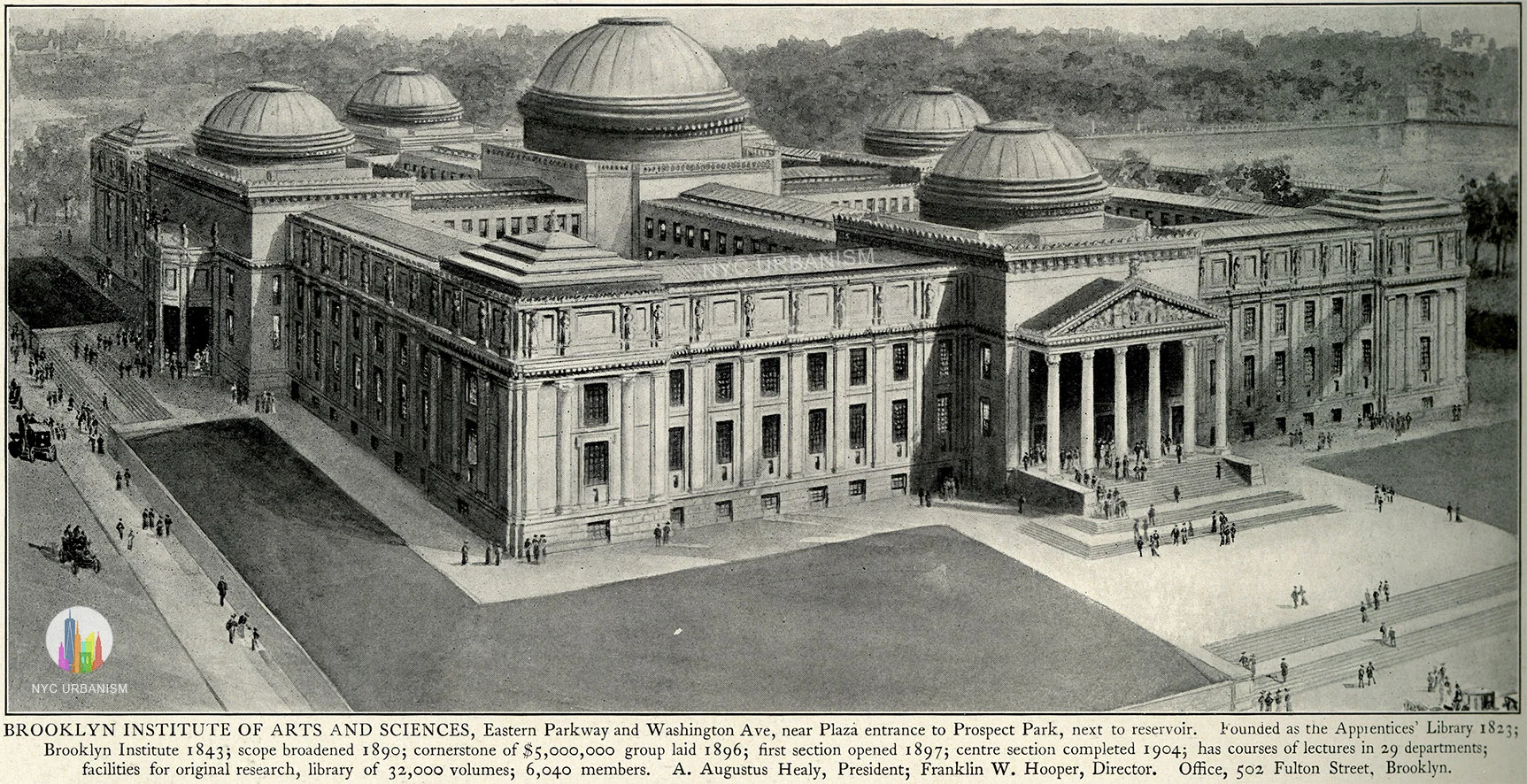
Original Design for Brooklyn Museum, 1905
from $22.99
sale
1848 View of City from Williamsburg
from $16.99
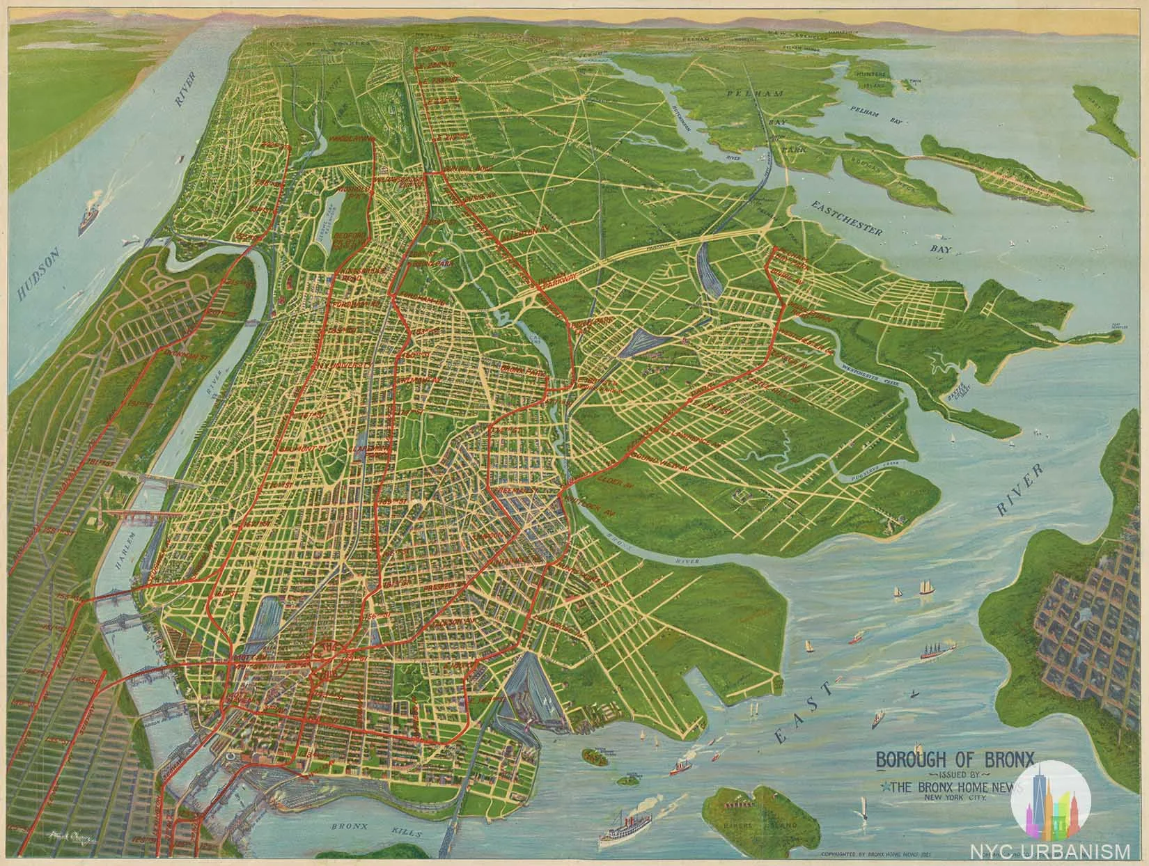
1921 Panorama of the Bronx
from $19.99
Lower Manhattan Expressway Rendering
from $15.99
sale
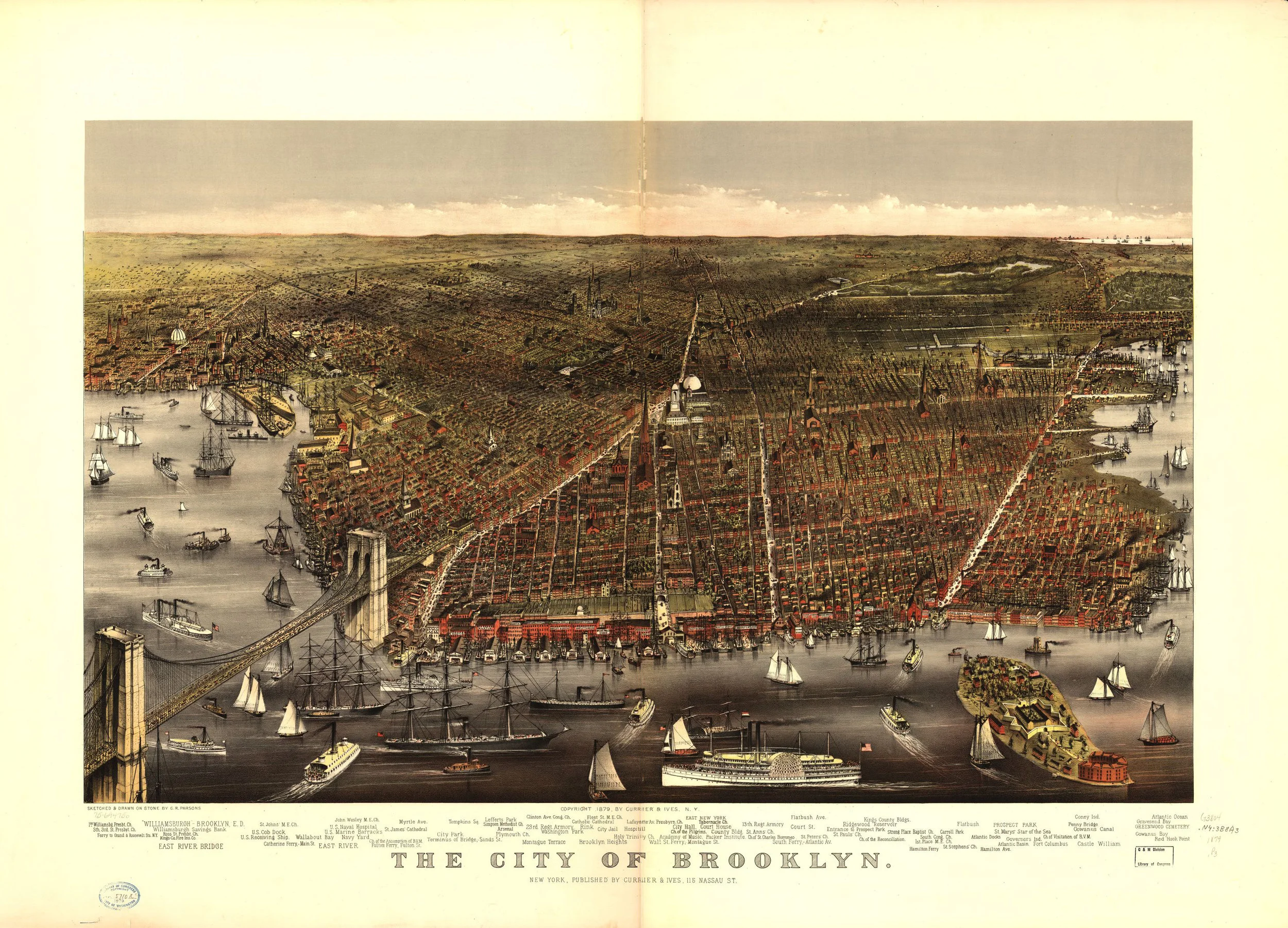
The city of Brooklyn, 1879
from $13.99
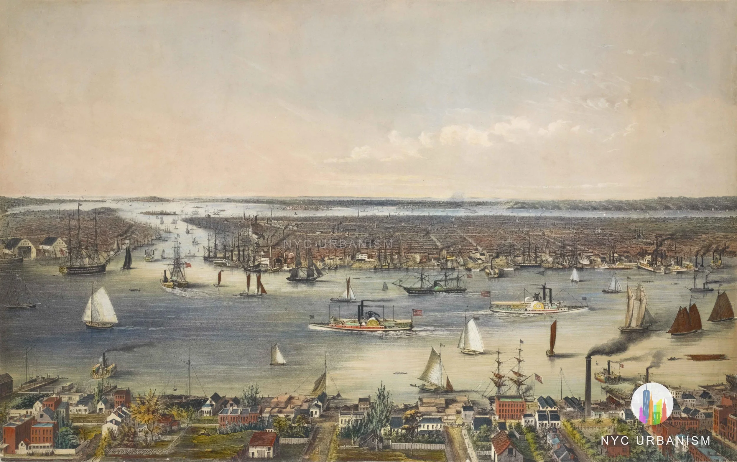
Aerial View of New York, 1879
from $16.99
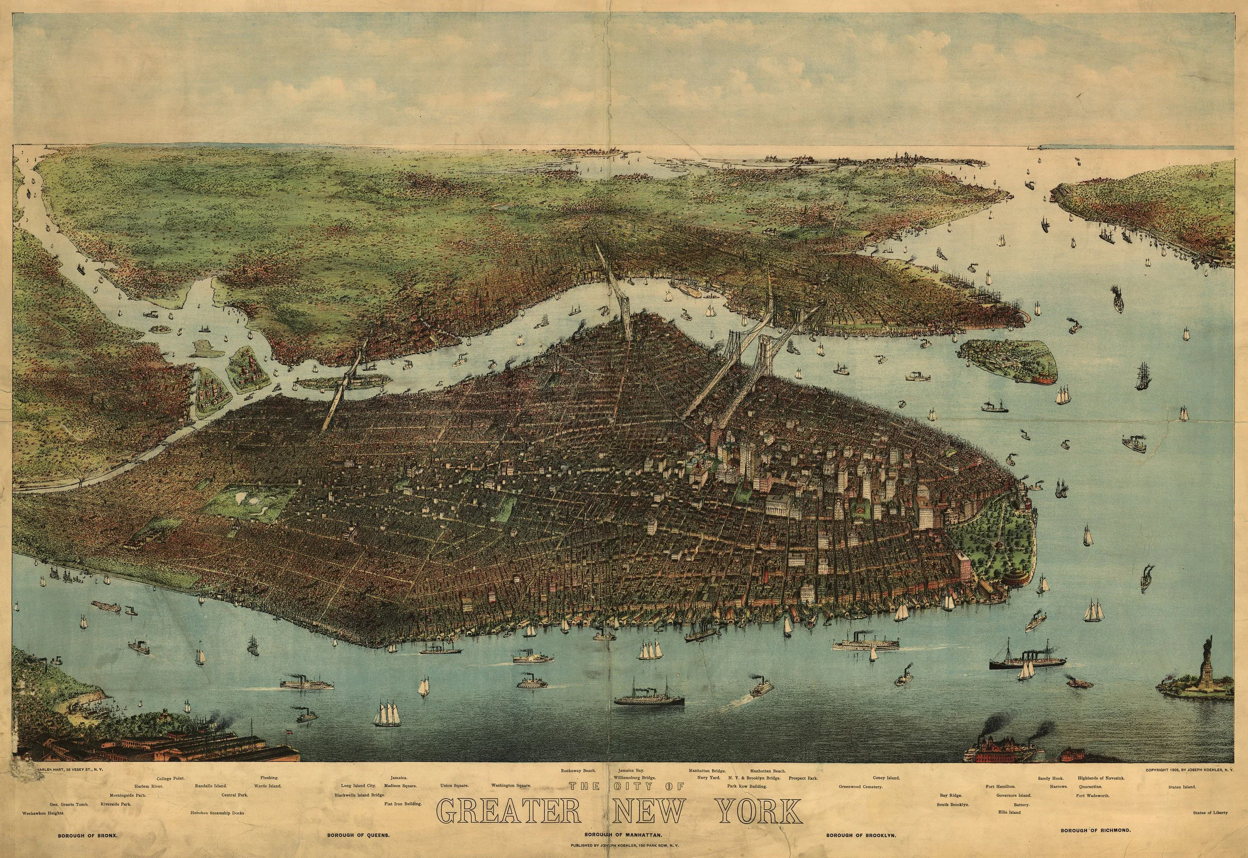
Bird's-eye View of Greater New York, 1905
from $12.99
Brooklyn-Manhattan Transit Company Map (1939)
from $17.99
1939 Land Use Map
from $17.99
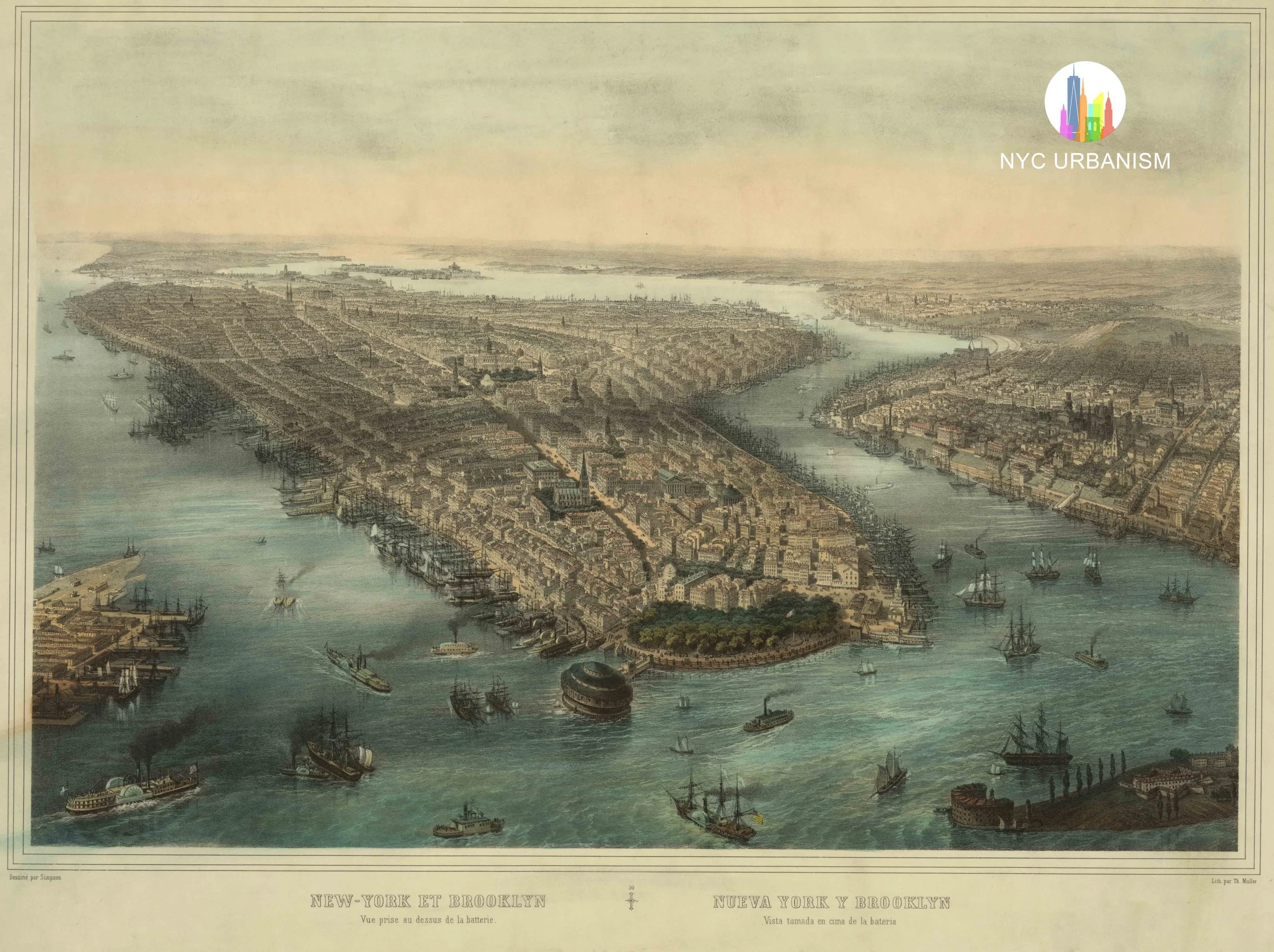
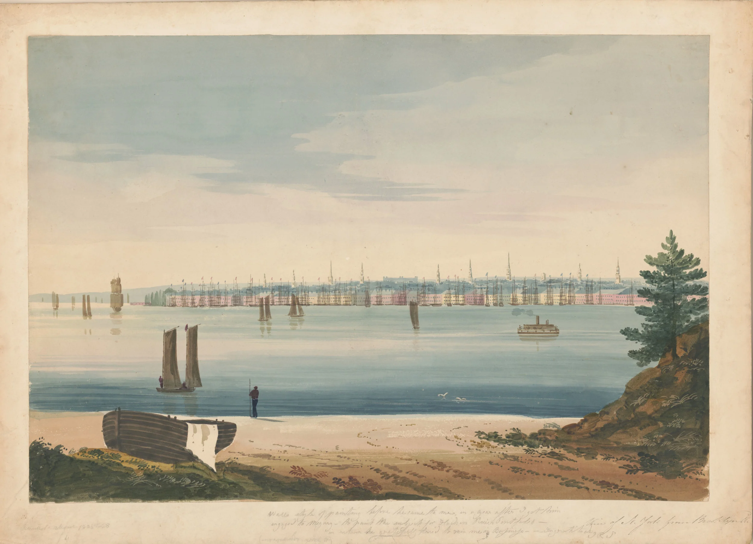
1850s View of New York and Brooklyn from the Battery
from $19.99
View of New York from Brooklyn, 1828
$30.00
Early Upper West Side Map (1879)
$22.99
Gift Cards
$20.00
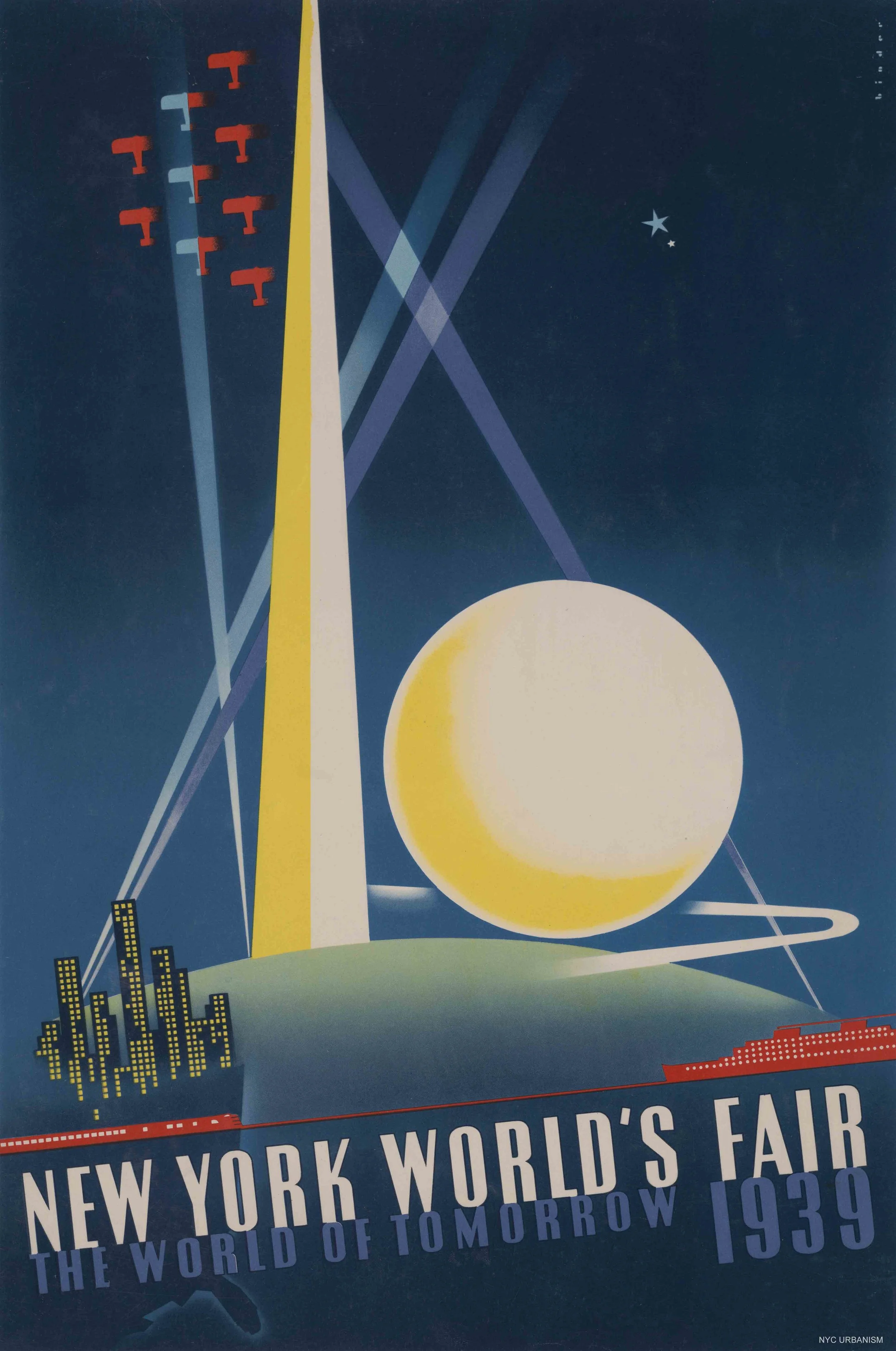
1939 World's Fair Poster
from $16.99
sold out
Woolworth Building
from $19.99
sold out
2020 Midtown Skyline
from $29.99
sold out
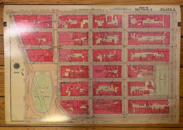
Union Square Vintage Land Map (1909)
Sale Price:
$17.99
Original Price:
$39.99
sale
Financial District Vintage Map (1909)
Sale Price:
$17.99
Original Price:
$39.99
sale
Lower Manhattan Expressway at Williamsburg Bridge (1967)
from $17.99
sale
1728 Map of British New York
Sale Price:
$19.99
Original Price:
$26.99
Driving Road Chart 1890
$19.99
NY Harbor Landfill Map
from $17.99
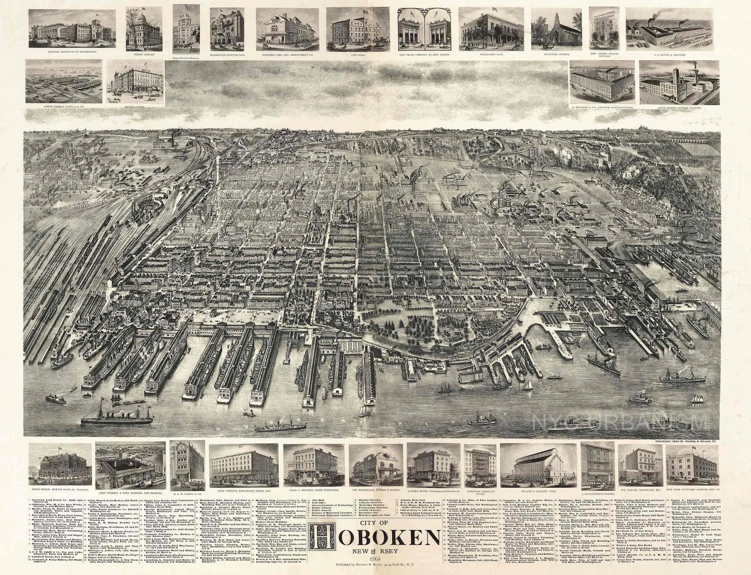
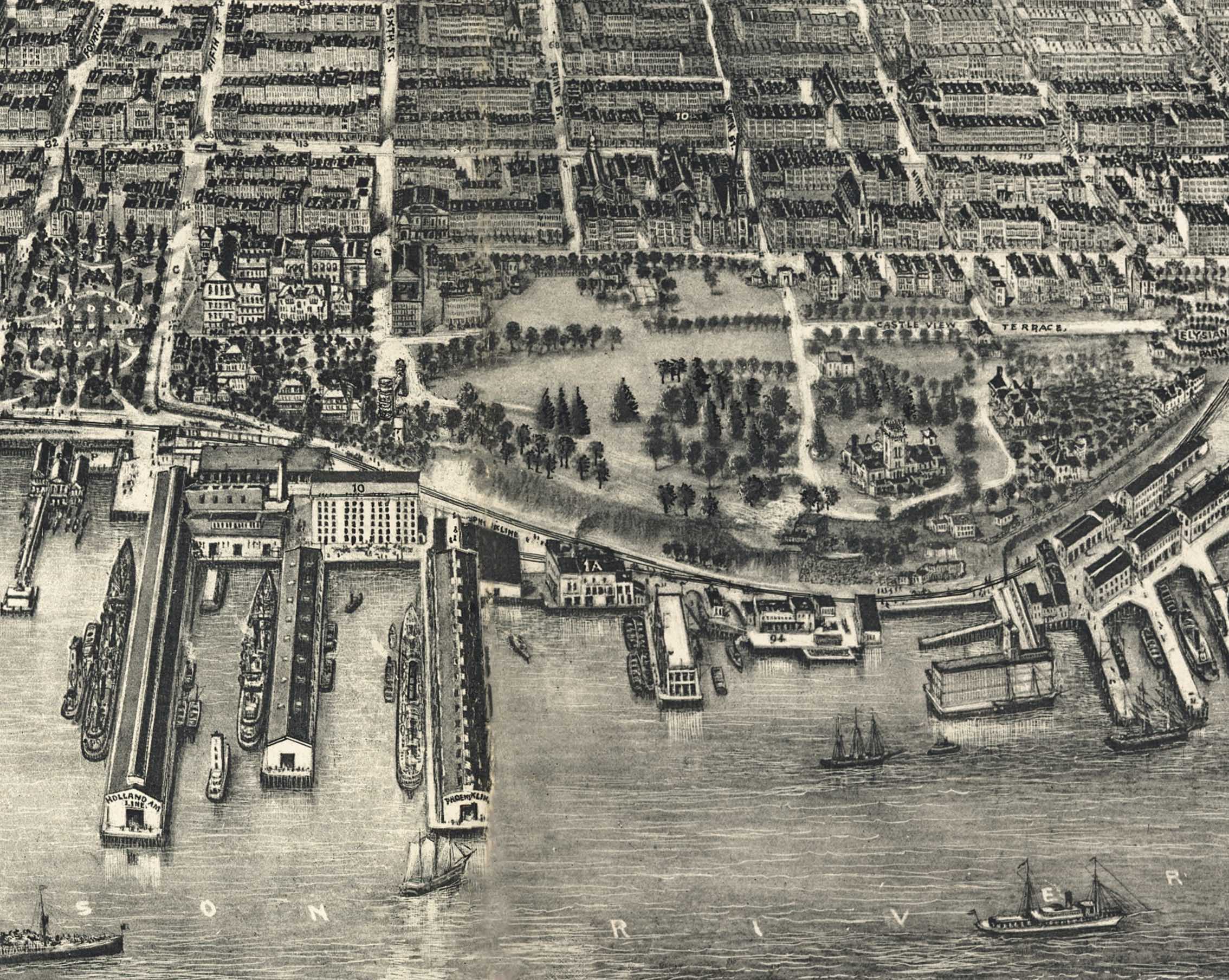
1904 Map of Hoboken, NJ
from $17.99
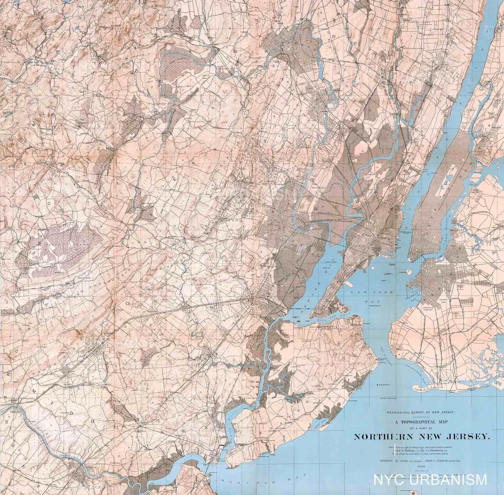
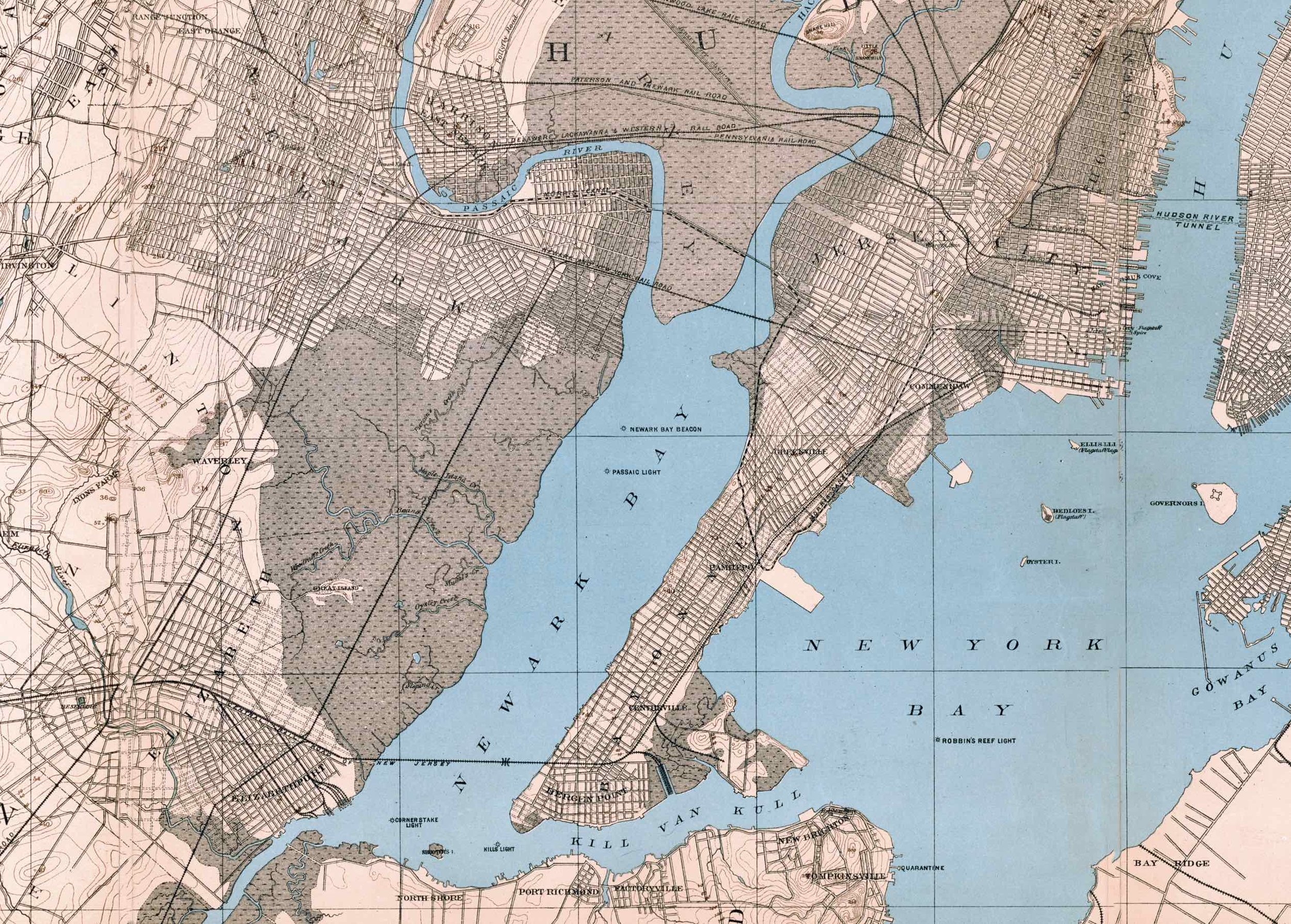
1882 Topographical Map of Northern New Jersey
from $18.99
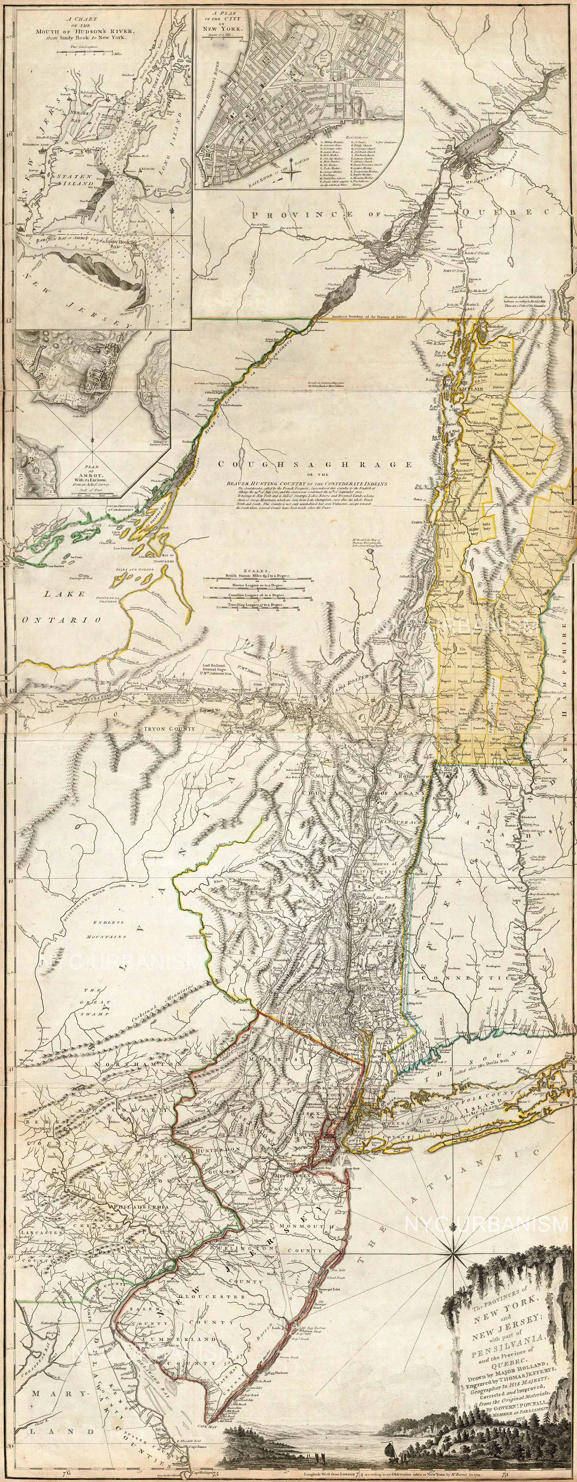
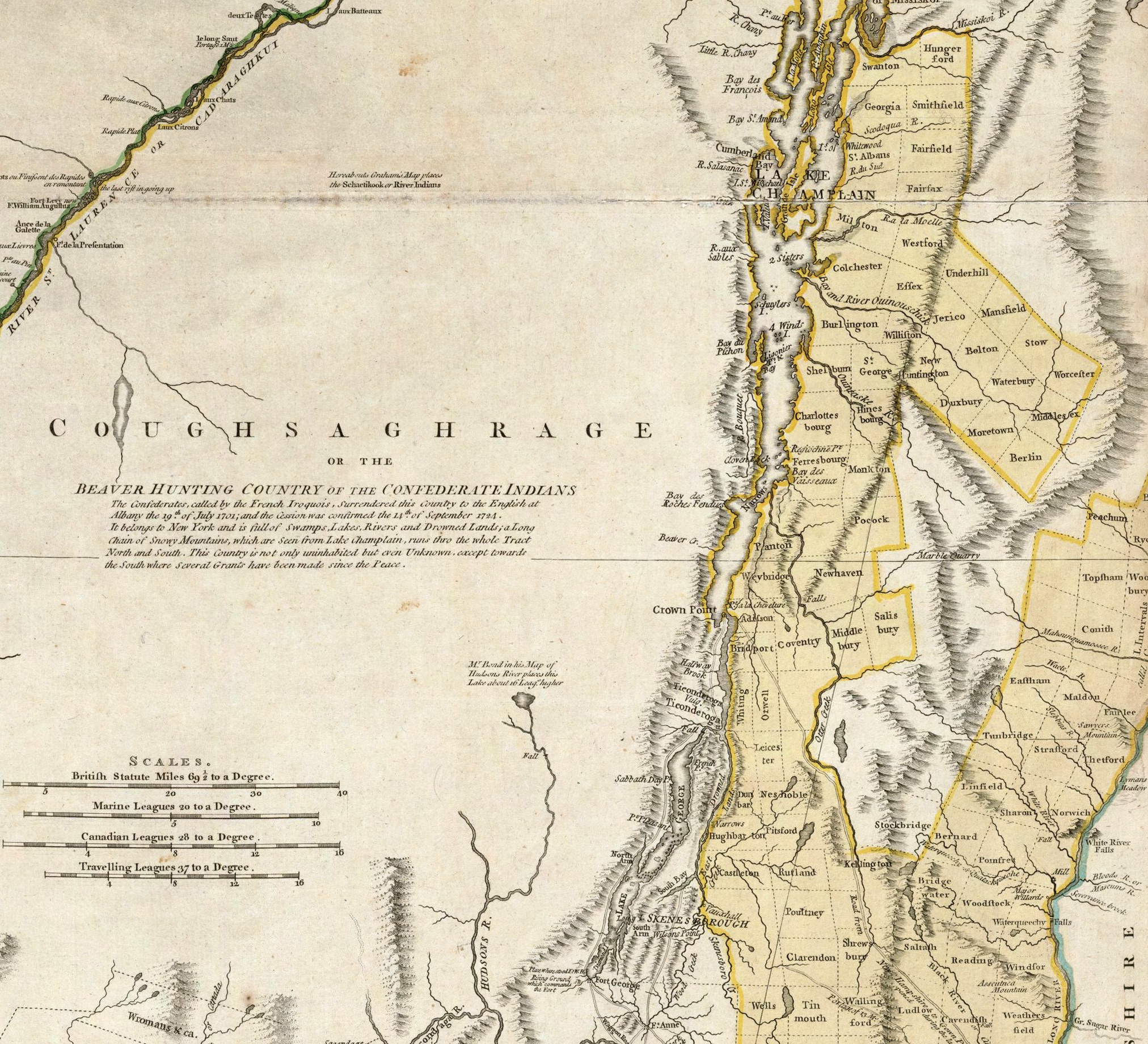
British drawn Revolutionary War era map
$22.99
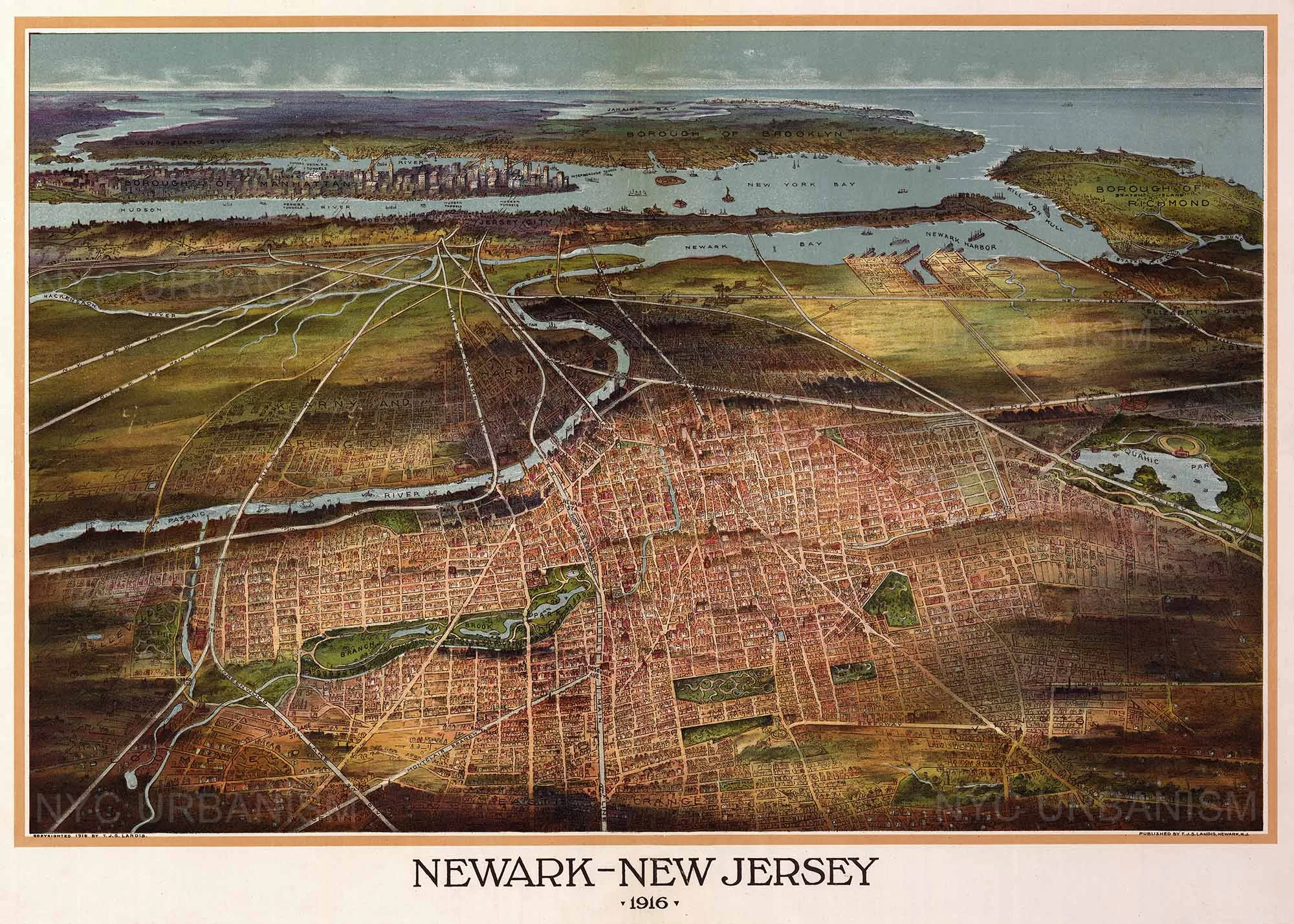
Map of Newark, 1916
from $18.99
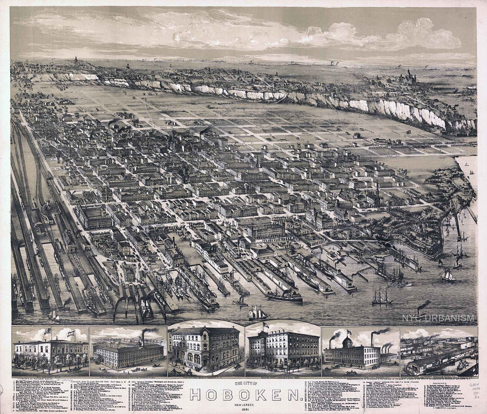
City of Hoboken, 1881
from $18.99
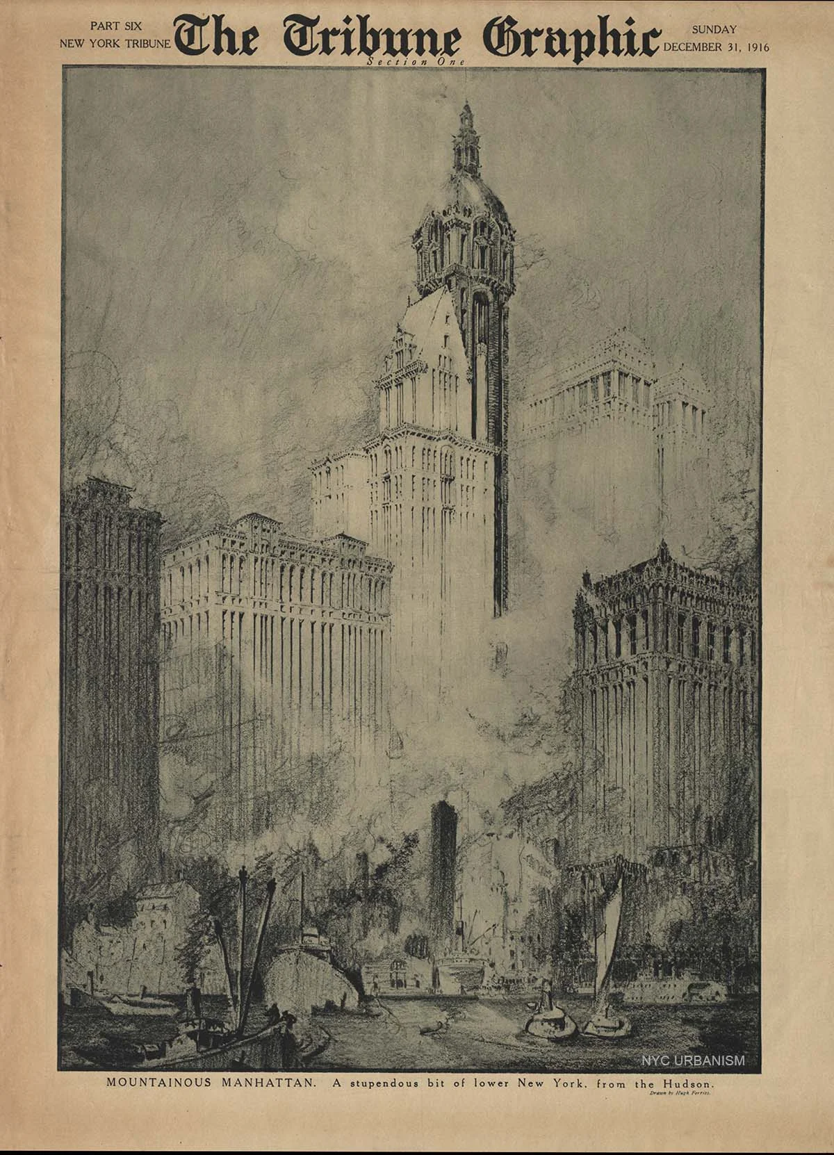
Mountainous Manhattan (1916)
from $16.99
sale
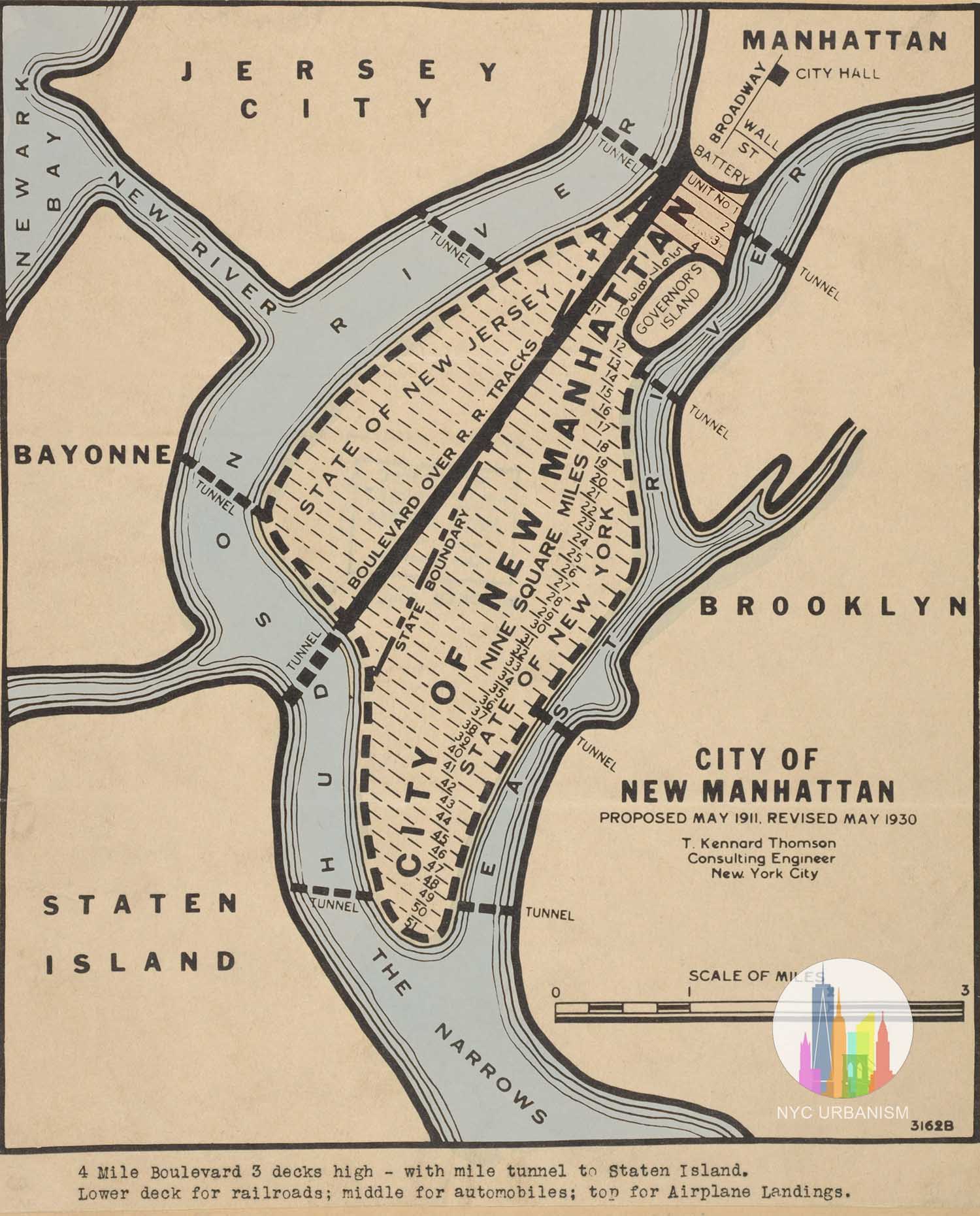
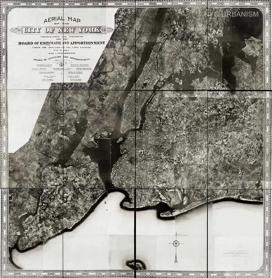
Aerial Map of the City of New York (1924)
from $16.99
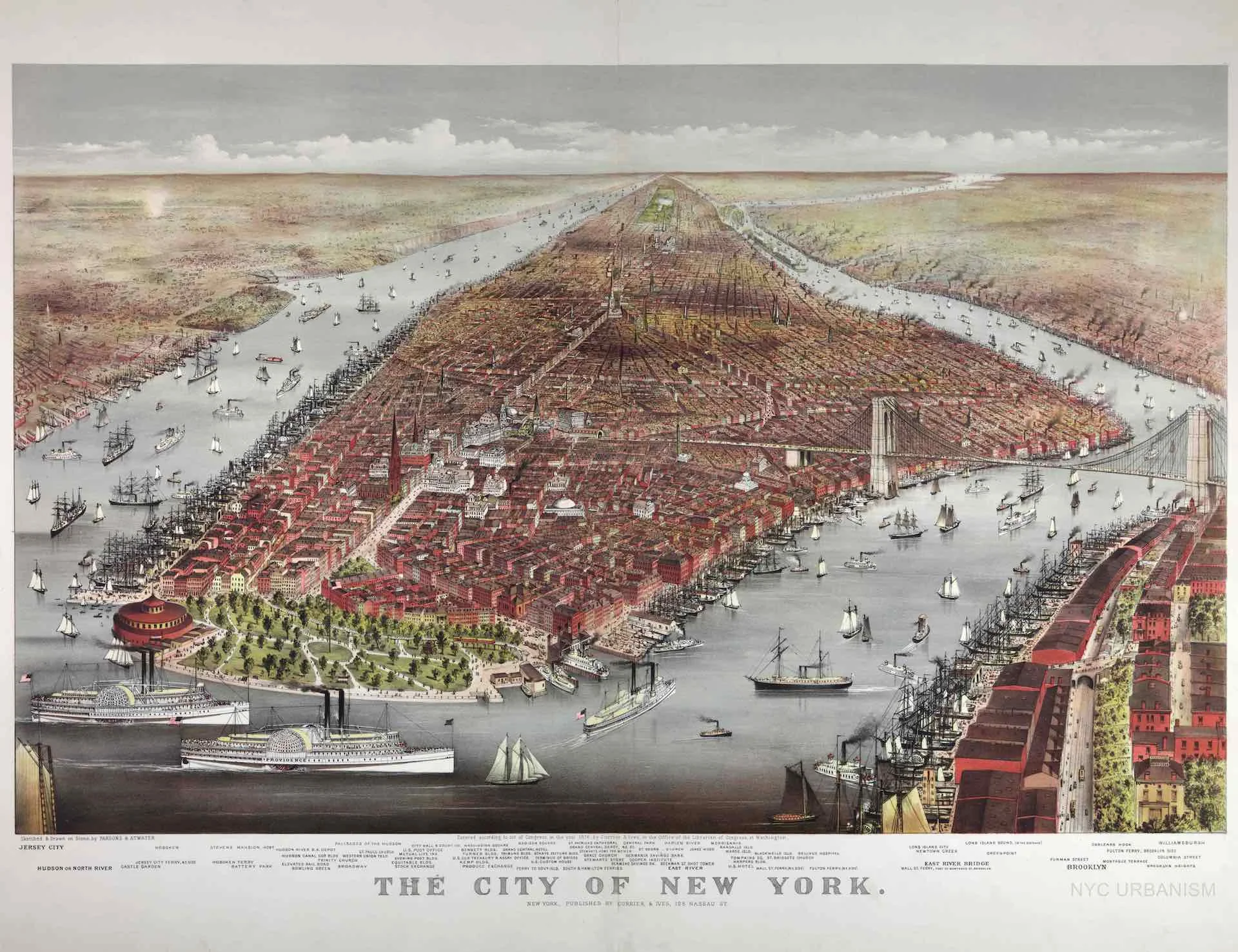
City of New York, 1876
from $19.99
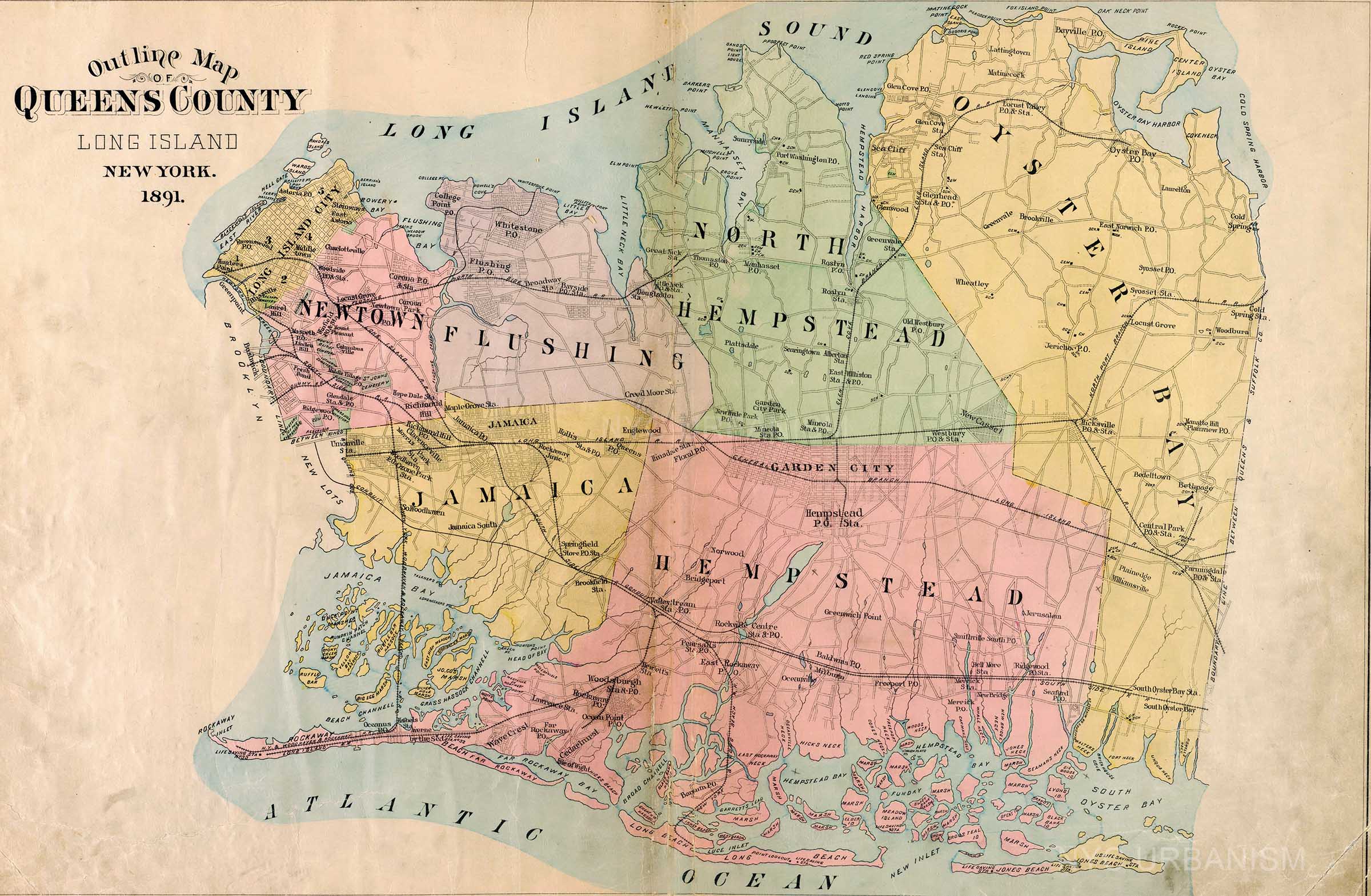
Queens County , 1891
from $19.99
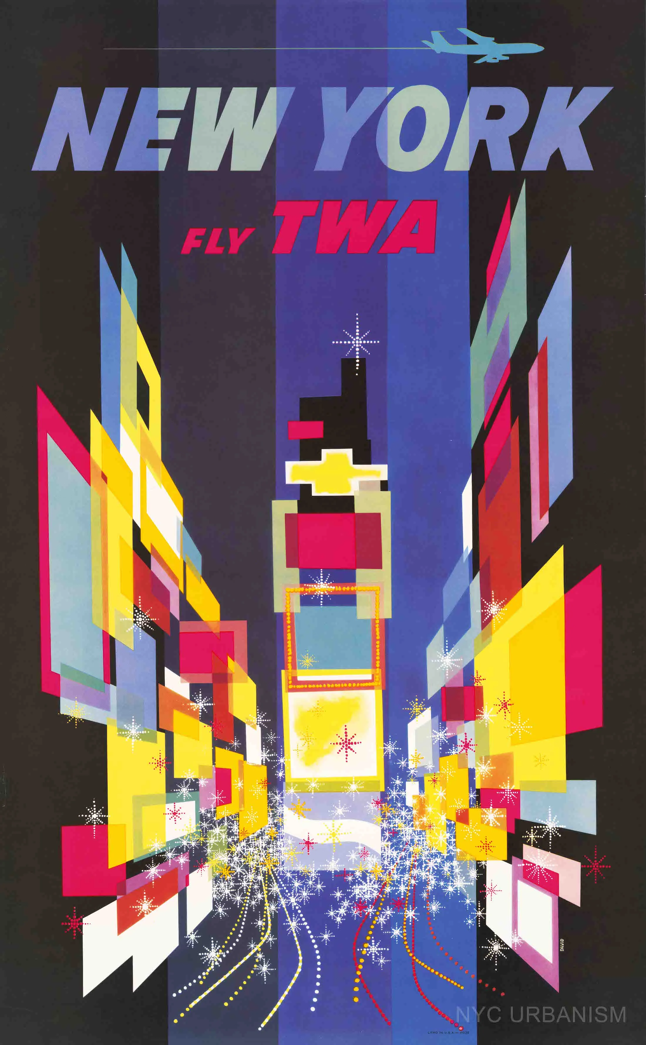
FLY TWA (Times Square)
from $19.99
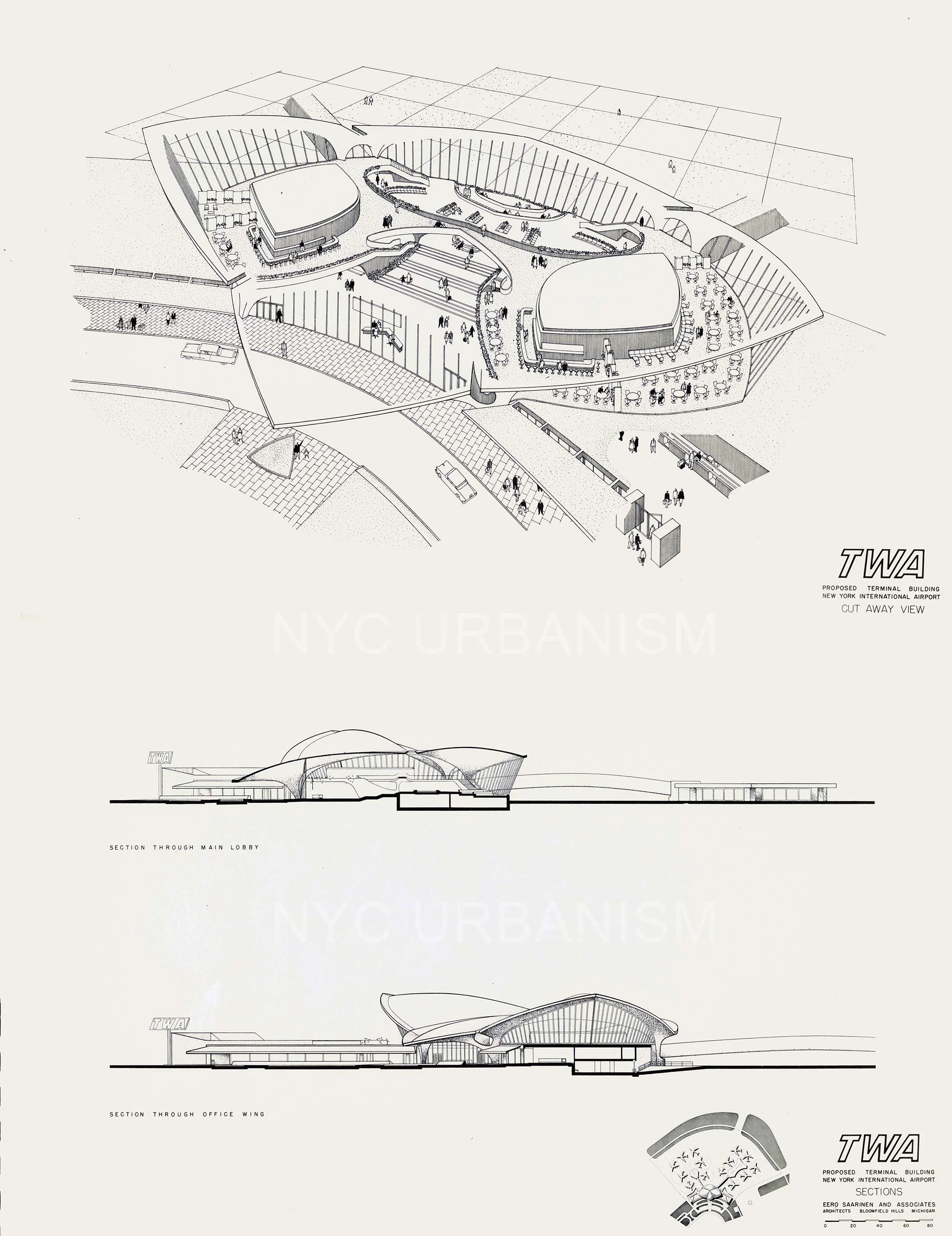
TWA Flight Terminal
from $22.99
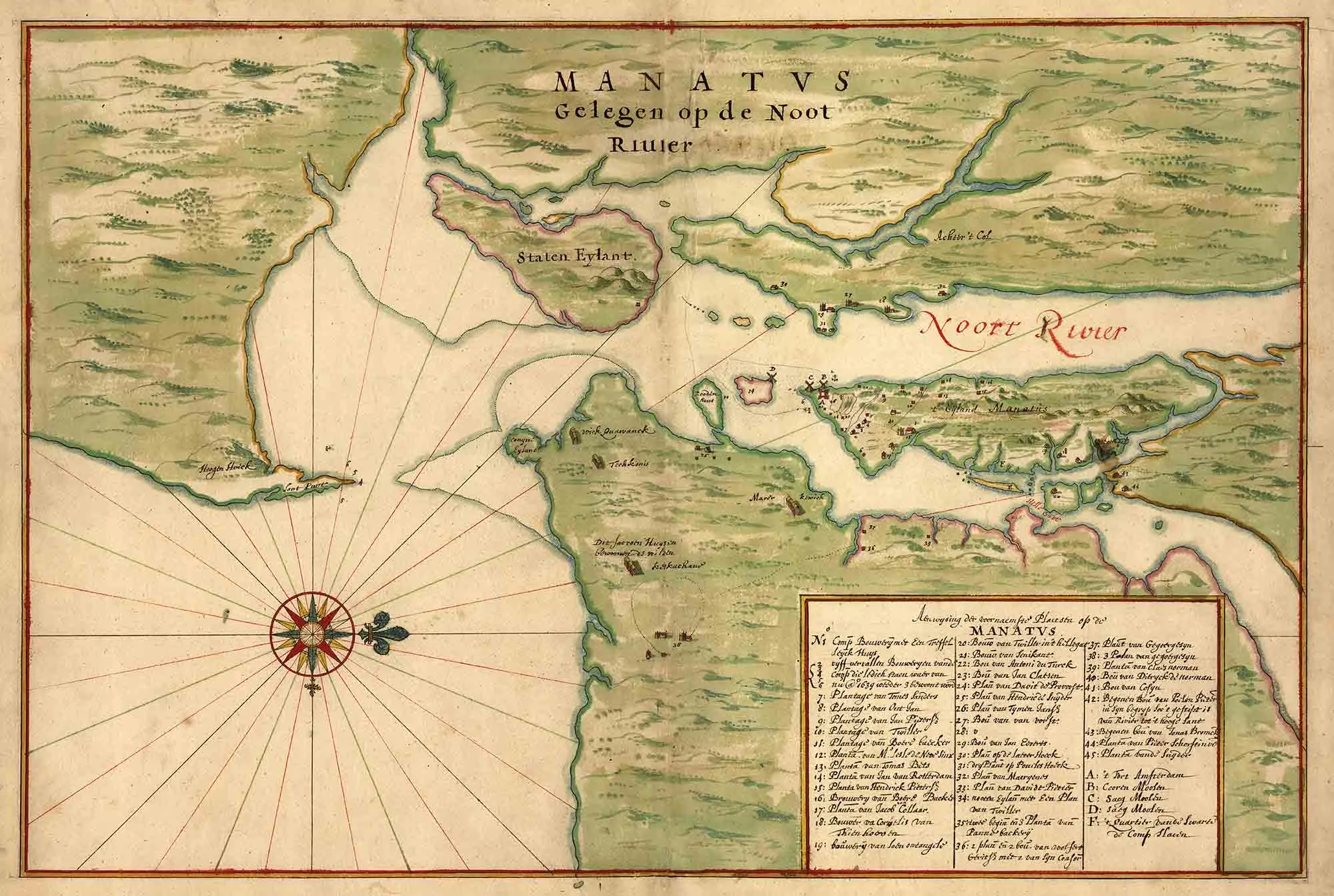
1639 Map of New Netherlands (NYC)
from $19.99
A New Yorker's Idea of the USA
from $29.99
sale
Aerial of Central Park, 1863
from $17.99
Long Island City Street Map (1900)
from $17.99
1905 Birds-Eye View of Manhattan
from $19.99
Grand Central - Terminal City Rendering
from $19.99
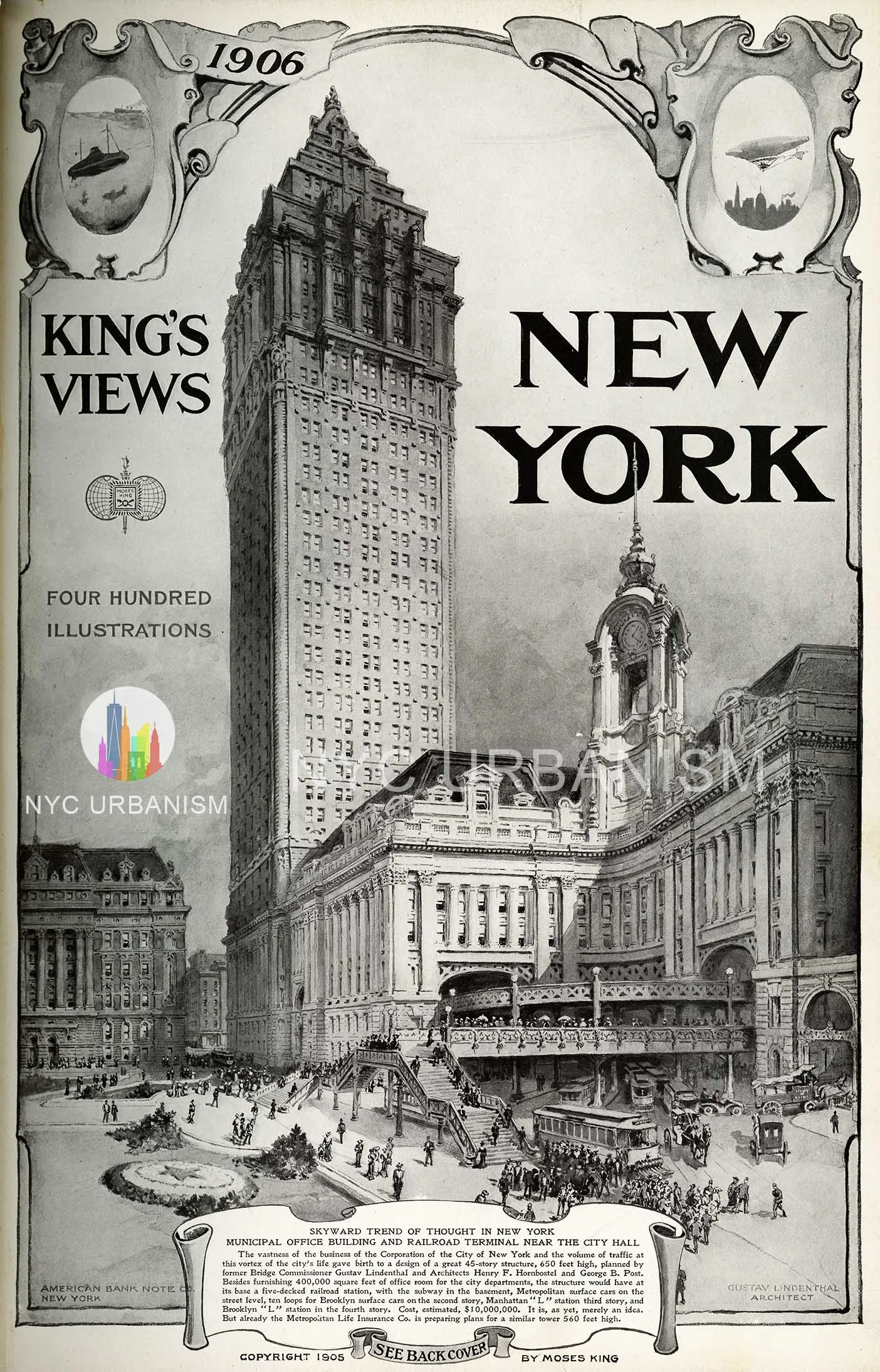
Unbuilt Municipal Building and Railroad Terminal, 1905
from $19.99
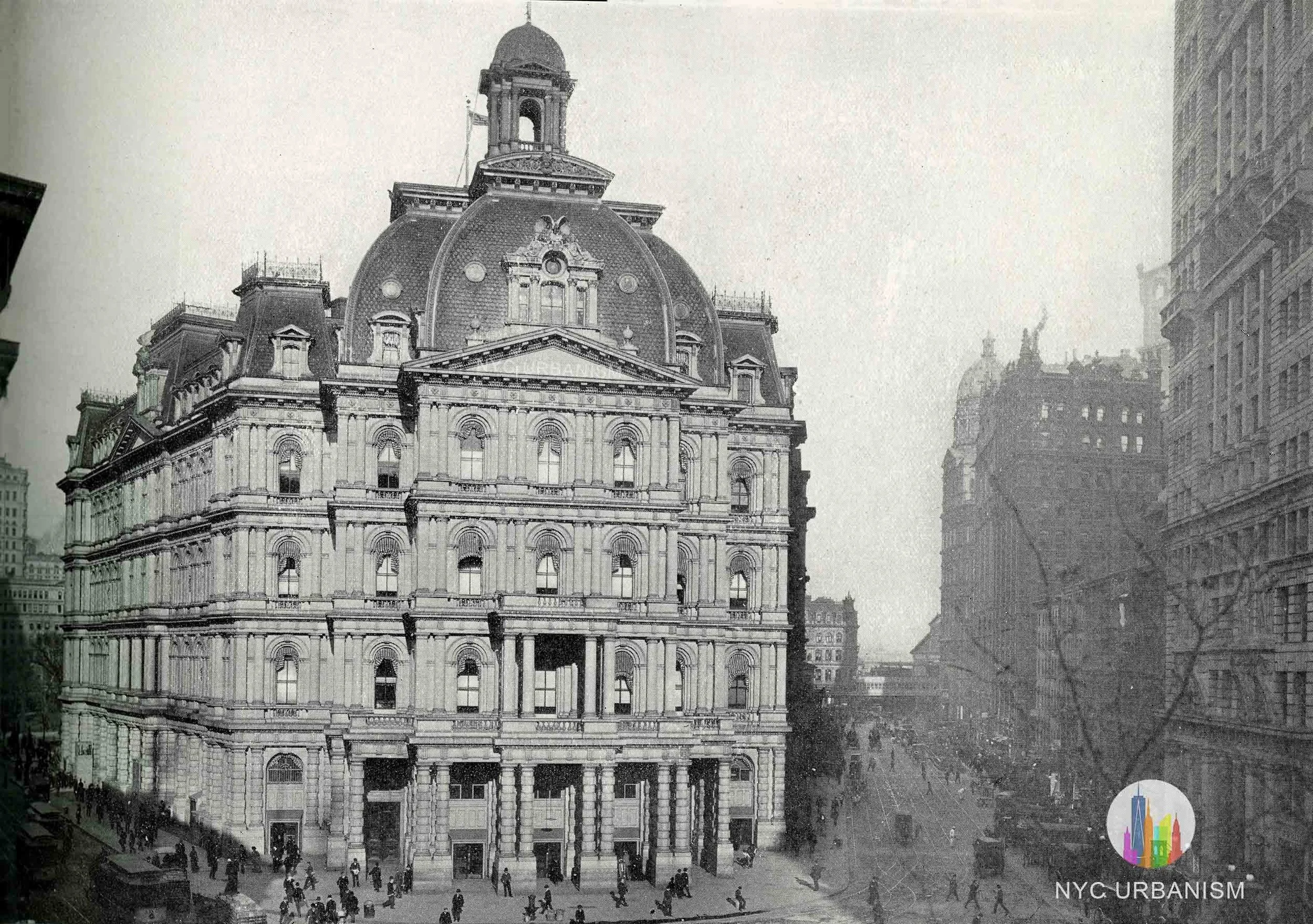
City Hall Post Office, 1905
from $19.99
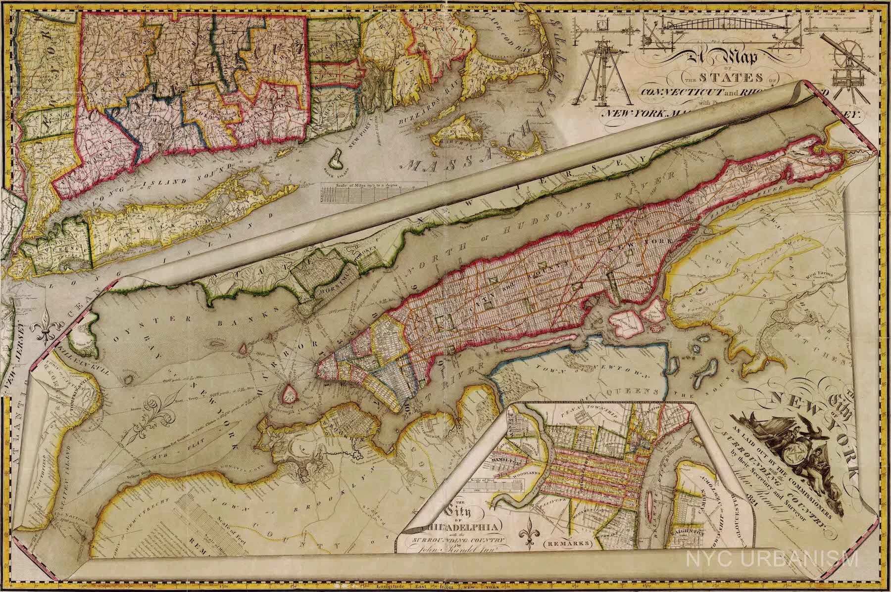
1821 John Randel map of the 1811 Commissioners Plan
from $19.99
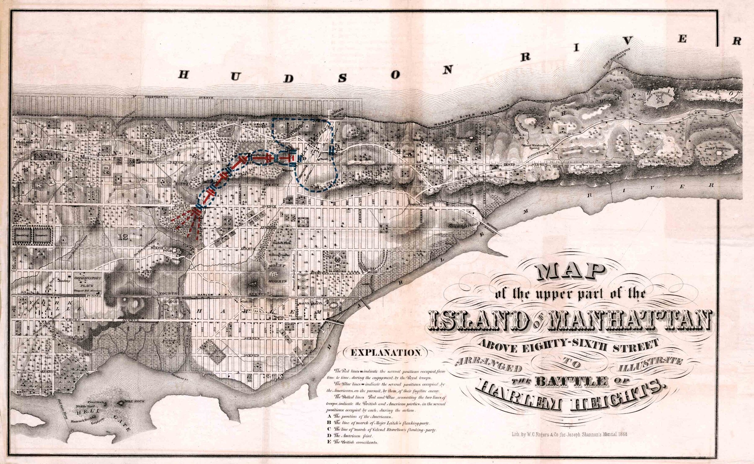
Battle of Harlem Heights Map
from $22.99
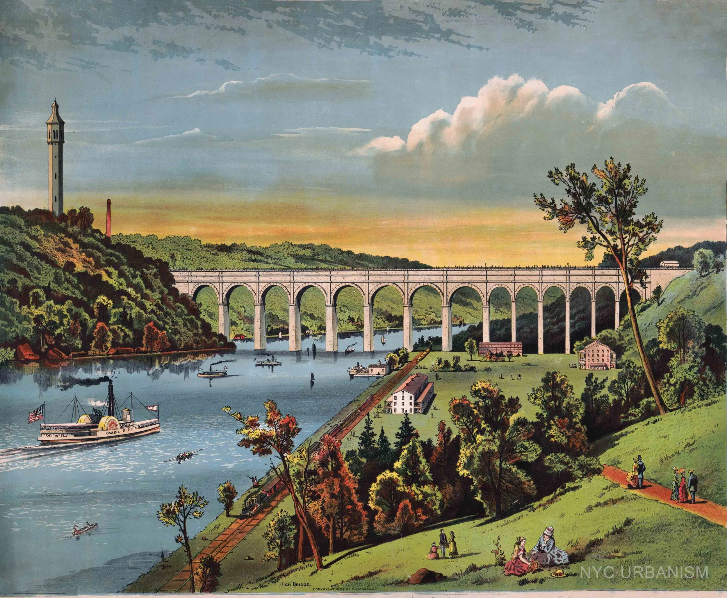
High Bridge, 1882
from $19.99
Pennsylvania Station Cross Section
$39.99
Penn Station General Waiting Room
$39.99
Penn Station View of Concourse
$39.99